Miami 4-day Road Trip
March 4 - 7, 2024
Sits visited: Miami, Everglades National Park, Biscaye National Park, Key West

Day 1 , March 4, 2024: Biscayne National Park, Miami South Beach
Day 2, March 5, 2024, 2024: Key West
Day 3, March 6, 2024: Everglades National park
Day 4, March 7, 2024: Miami: Design District, Wynwood, Little Savana
Map Overview

Miami Metro
Itinerary
Day 1, March 4, 2024
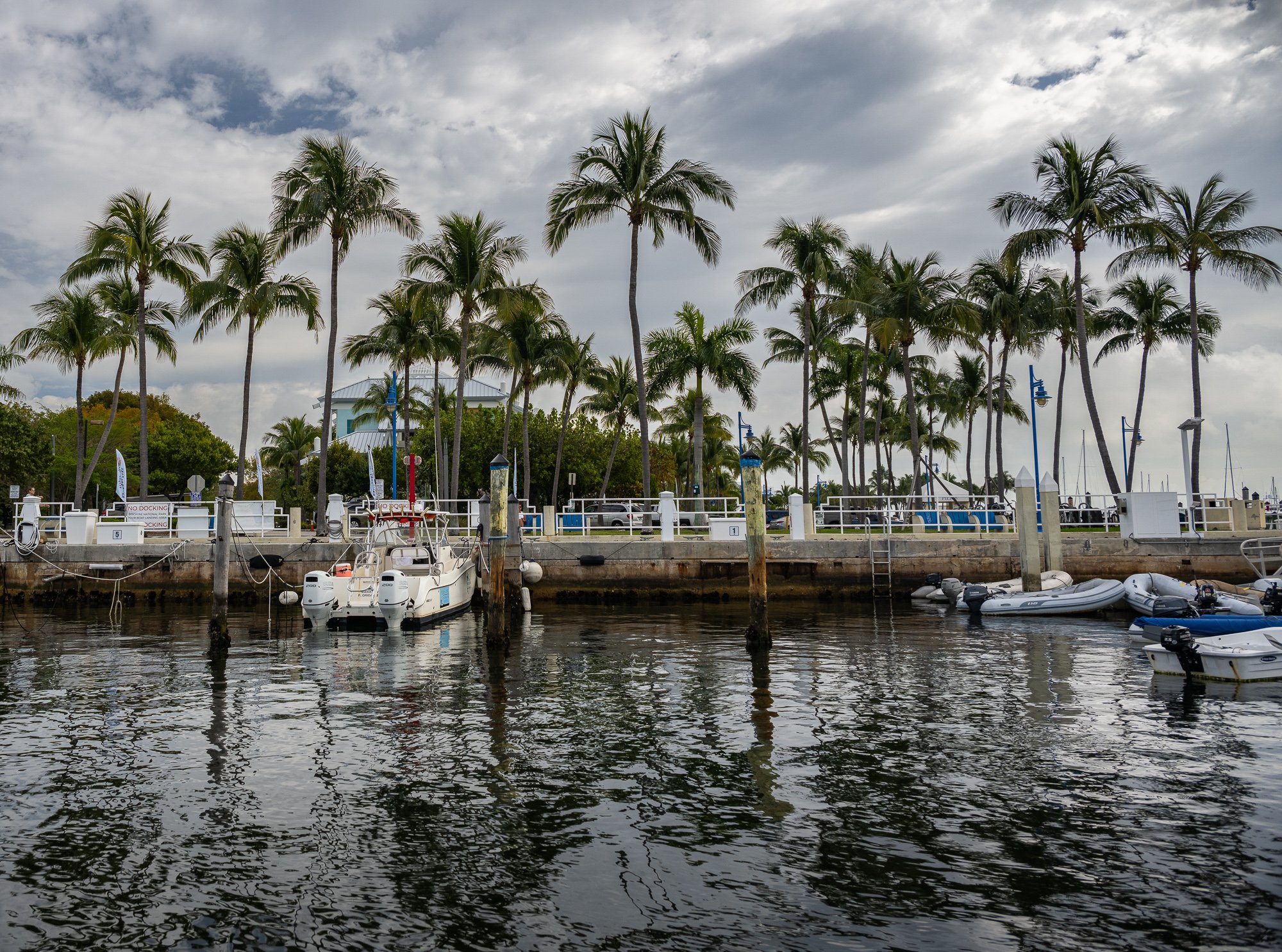
For the morning, we booked a 3.5 hour Boca Chita Key Heritage Cruise from Coconut Grove for Monday morning, 9:15AM - 12:45PM, run by Biscayne National Park Insitute, a nonprofit organization and official touring services partner of the national park.
https://www.biscaynenationalparkinstitute.org/island-experiences/boca-chita-key-heritage-cruise
Onboard
The doc is Dinner Key Marina at Coconut Grove. We received very detailed instruction on parking and location of the boarding doc prior. We run about 5 minutes late that morning for our lack of knowledge of Miami rush hour traffic. When we called the cruise team when we were stuck in traffic, the associate was very patient and remind us to fill out the waiver before we got there. Once we boarded, after our captain Stephan went through the safety rules, our cruise started. There was also a biologist Jenna on the boat so while we moving out of the cove, she gave us some great info about the ecosystem and history of the park.
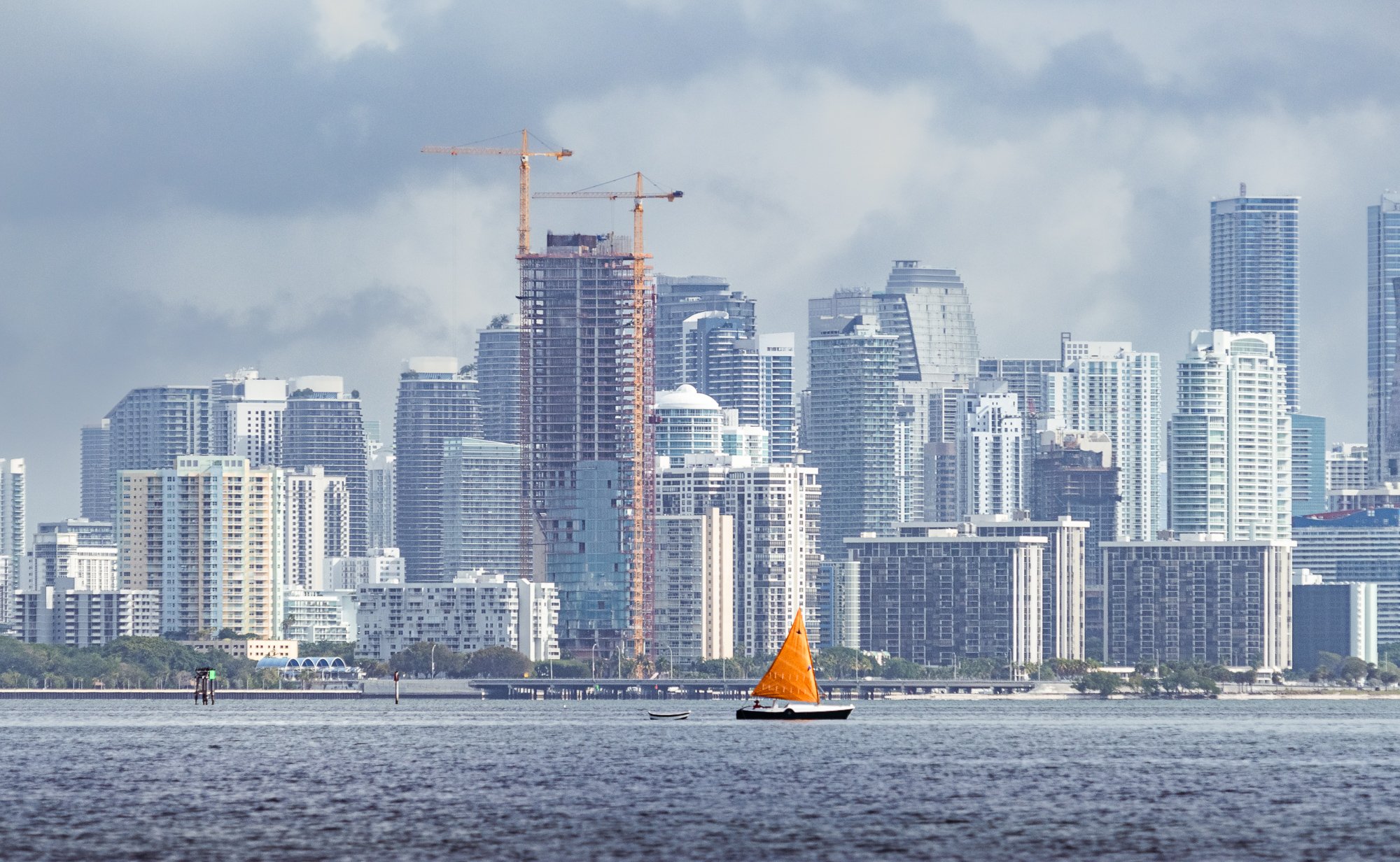
The first sights was the skyline of Miami. We had an overcasted morning, so no harsh sunlight and the scene looks very nice. Then we soon passed by the Bill Baggs Cape State Park and had a nice view of the white lighthouse on the tip of the park’s tip. Jenna reminded us that they run sunset cruise as well. I think the view of the sunset golden hour would be fantastic.


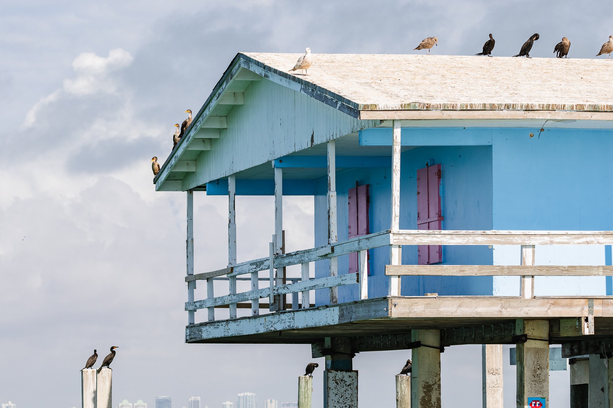
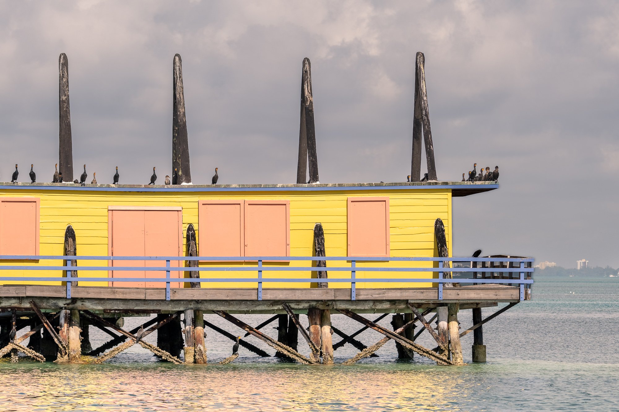
Stiltsville
About one mile in, several structures floating on the ocean came to our sight when we got closer. These are six historic Stiltsville Houses that used to be playground for the wealthy. Jenna talked about her experiences of visiting these with family in the weekend when she was a child. First shack was built on stilts above the water in 1933 allegedly to facilitate gambling in prohibition era. More shacks were built later on and were used as social clubs. This area went through rounds and rounds of hurricane damage and rebuilt, and even had its own mayors back then. Stiltsville’s frontier era ended when the state of Florida’s building codes change in 1965. In June 1980, Congress expanded the Biscayne National Park boundaries bringing the area containing Stiltsville within the park. After Hurricane Andrew struck Stiltsville in 1992, 14 “campsites” dropped to only seven. In 2003, a non-profit organization called Stiltsville Trust was established to raise fund and to preserve and rehabilitate. the structure to help showcase the park’s marine resources with support for education and interpretive services.
Biscayne National Park Institute offers a 2-hour Stiltsville Guided Tour 12:30 - 3:00PM Thursday - Sunday https://www.biscaynenationalparkinstitute.org/stiltsville-guided-tour-from-coconut-grove/. Some of the houses became popular for some snorkelers and bird watchers.


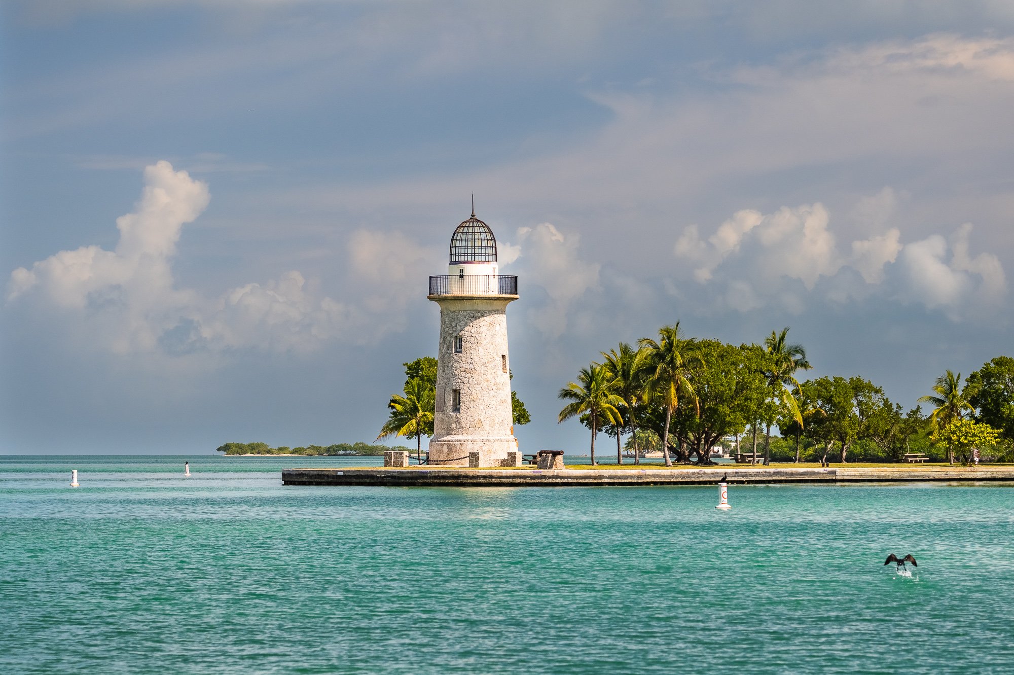
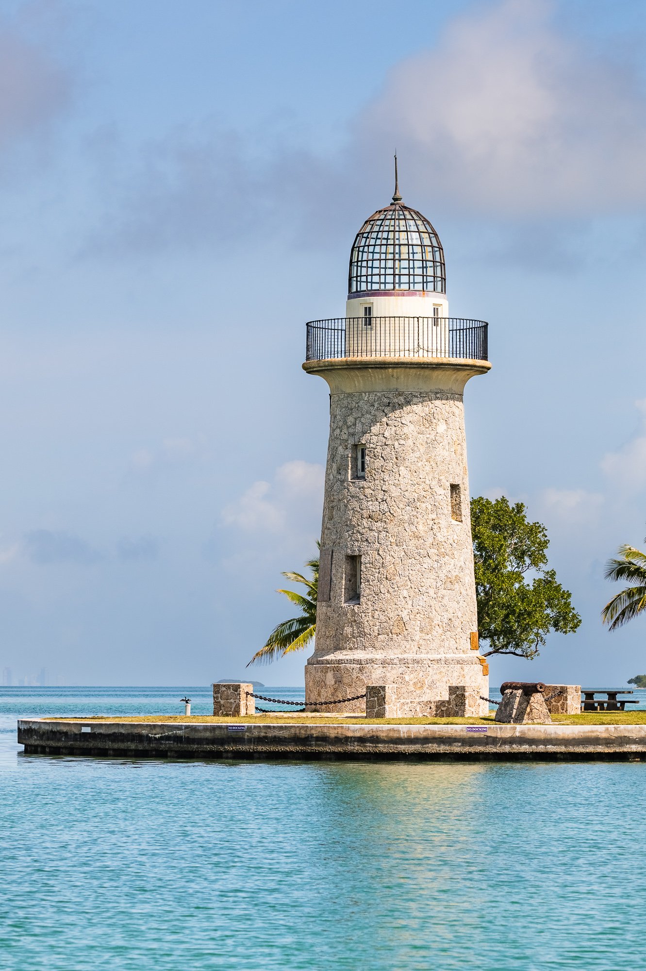
Boca Chita Key
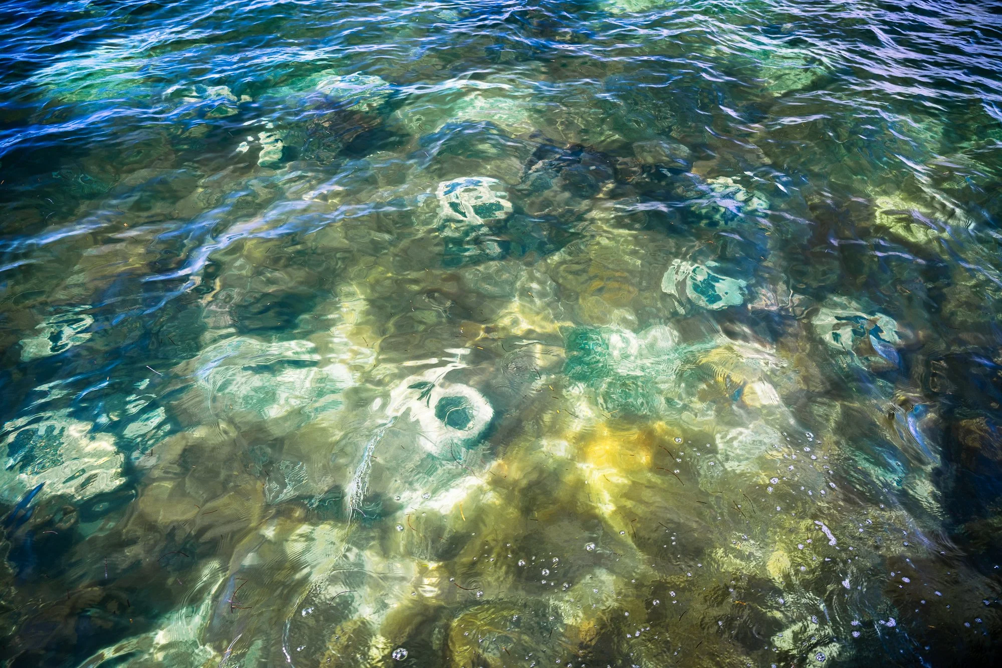
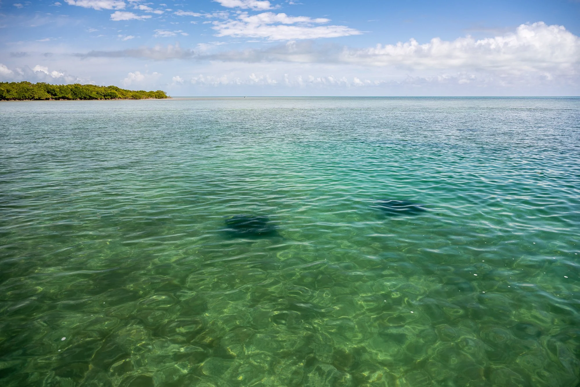
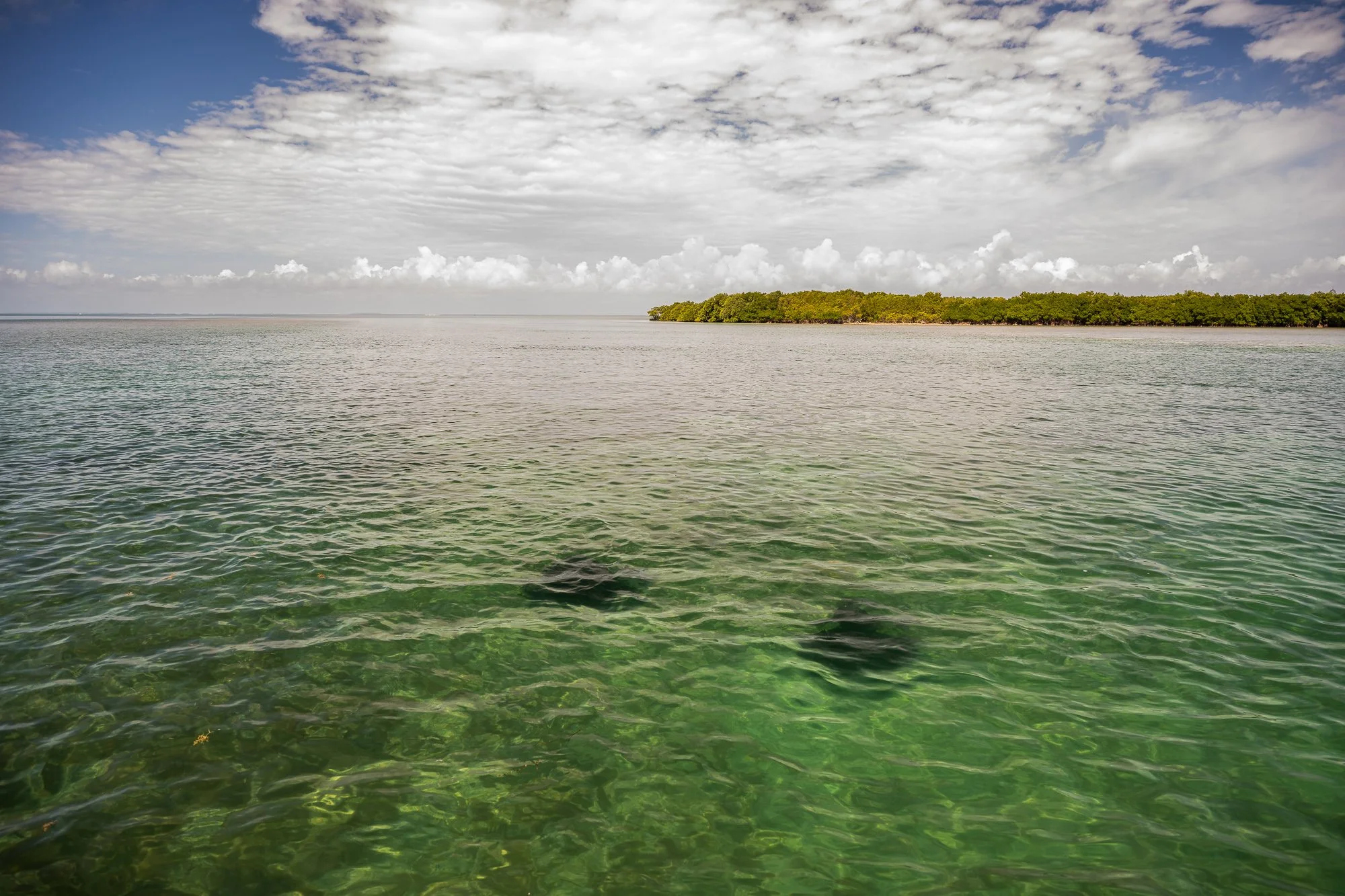
Before we reach Boca Chita Key, we had a very good biology field trip on our way to the island. Right passed Stiltsville, the captain slowed the boat so that we can check out the sponges underwater in the format of white rounded shape with a dark heart. Sponges are an irreplaceable component of a delicate marine ecosystem as they filter water, and their porous bodies provide habitats for smaller organisms such as juvenile fish and crabs. When we got closer to Baco Chita Key, we started seeing sea star in orange bright color, colorful tropical fishes, then surprisingly several sting rays, the sight of which even excited Jenna as she claimed that it has been rare to identify them even for her.
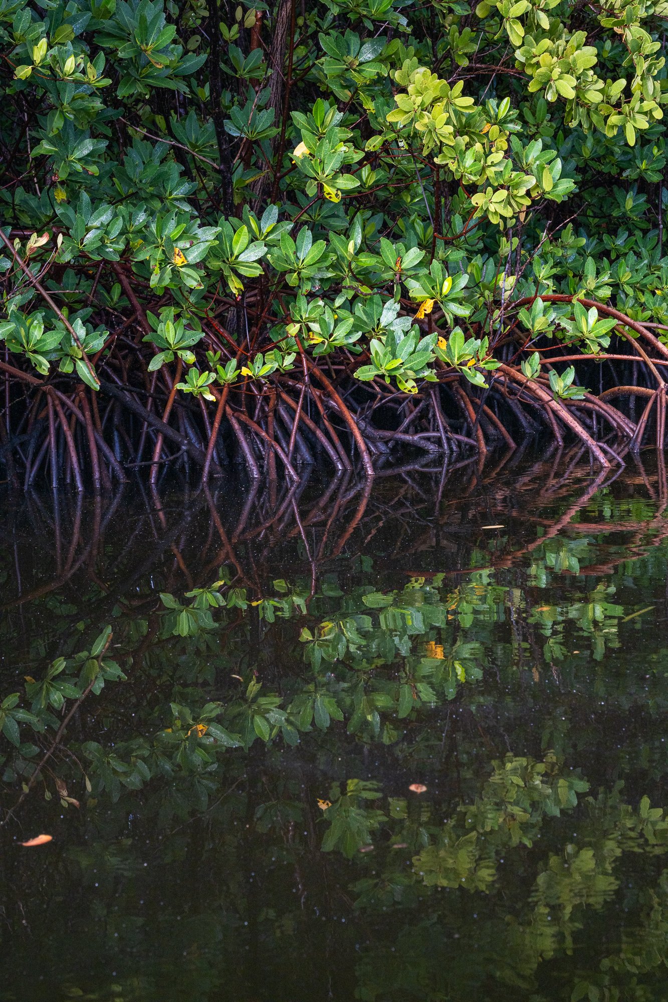
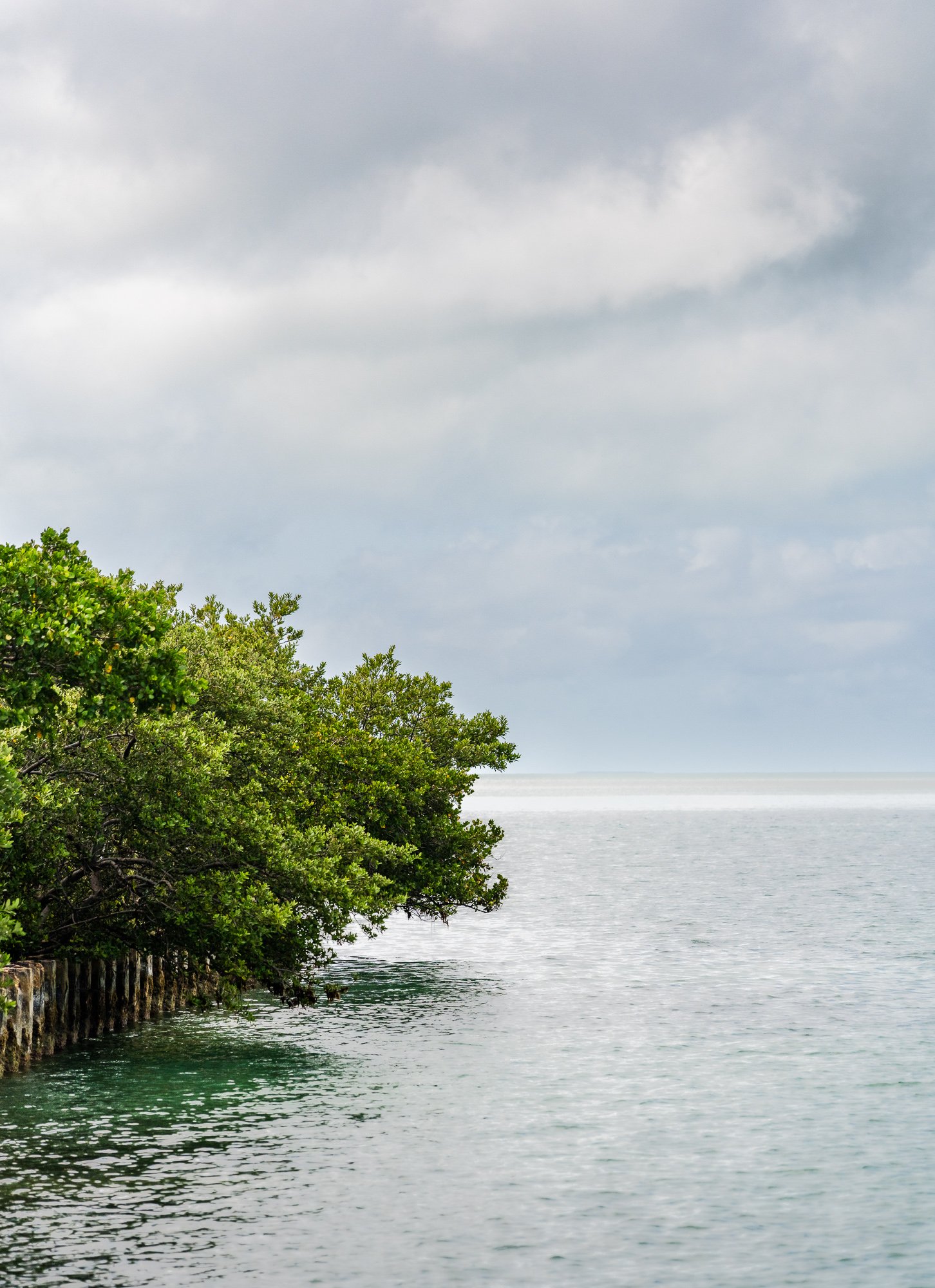
Boca Chita Key used to be owned by Mark Honeywell, and was used as a social club for the industrialists back in 1940s. In 1985 the island was added to Biscayne National Park. The most famous structures on the island are the ornamental lighthouse and the coral rock structures. The boat parked at the harbor and give us half hour to tour the island on our own. It has restrooms but no drinkable water supply. We walked cut cross to the opposite side of the harbor, and had a beautiful view of the mangrove trees and some ocean birds. After hiked north shoreline of the island, we also hiked half section of the natural trail on the west side.
This is our last stop of the cruise. We had a nonstop ride back to the dock after visiting this island.
By far, we only covered a small portion of the park in the north. Other fun activities you can plan if you have more time could be paddle board in the mangrove between and around some islands, snorkeling or scuba diving in coral reef, and visit historic side of ship wrecks.


NPS Map of Boca Chita Key
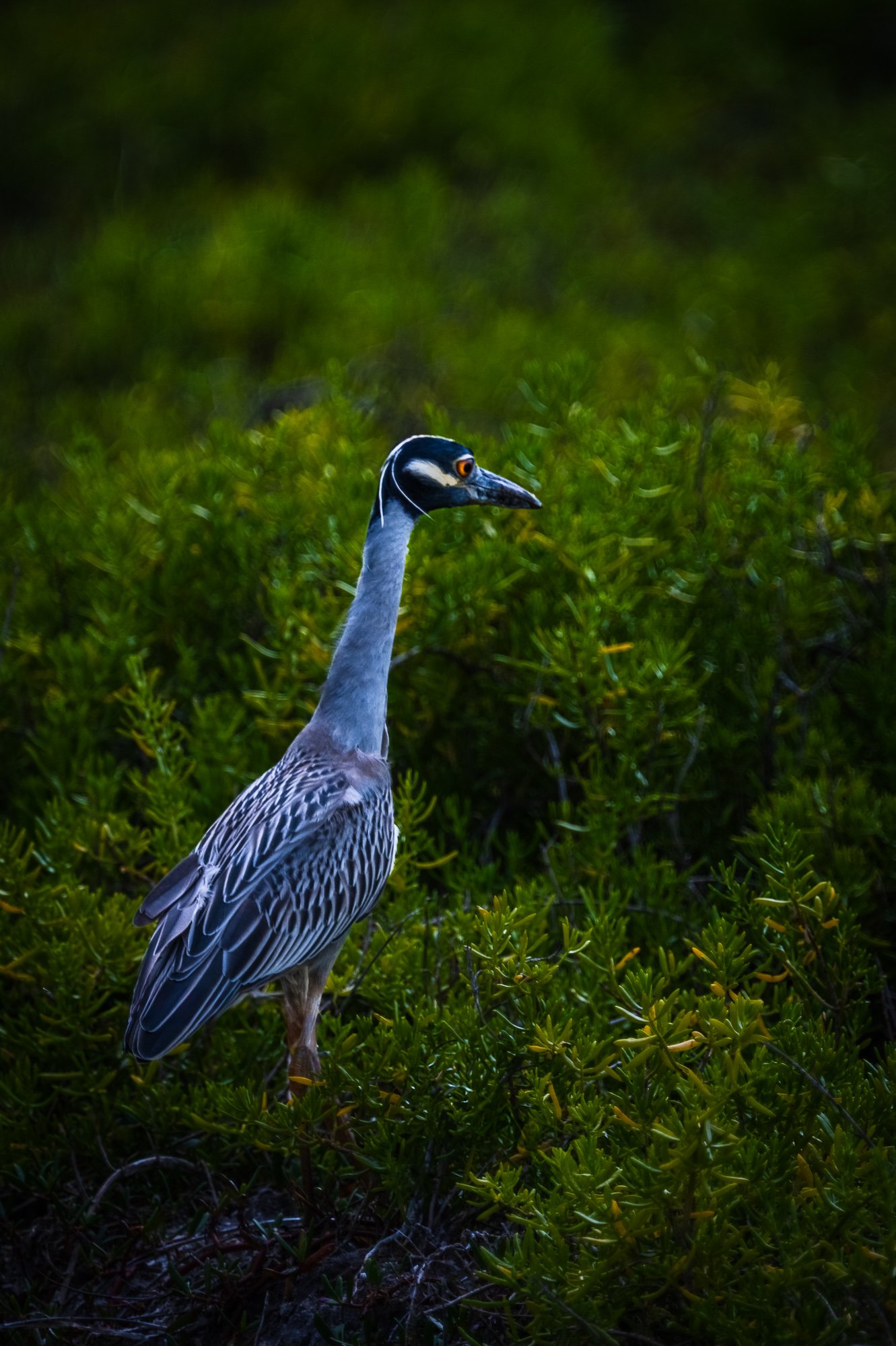
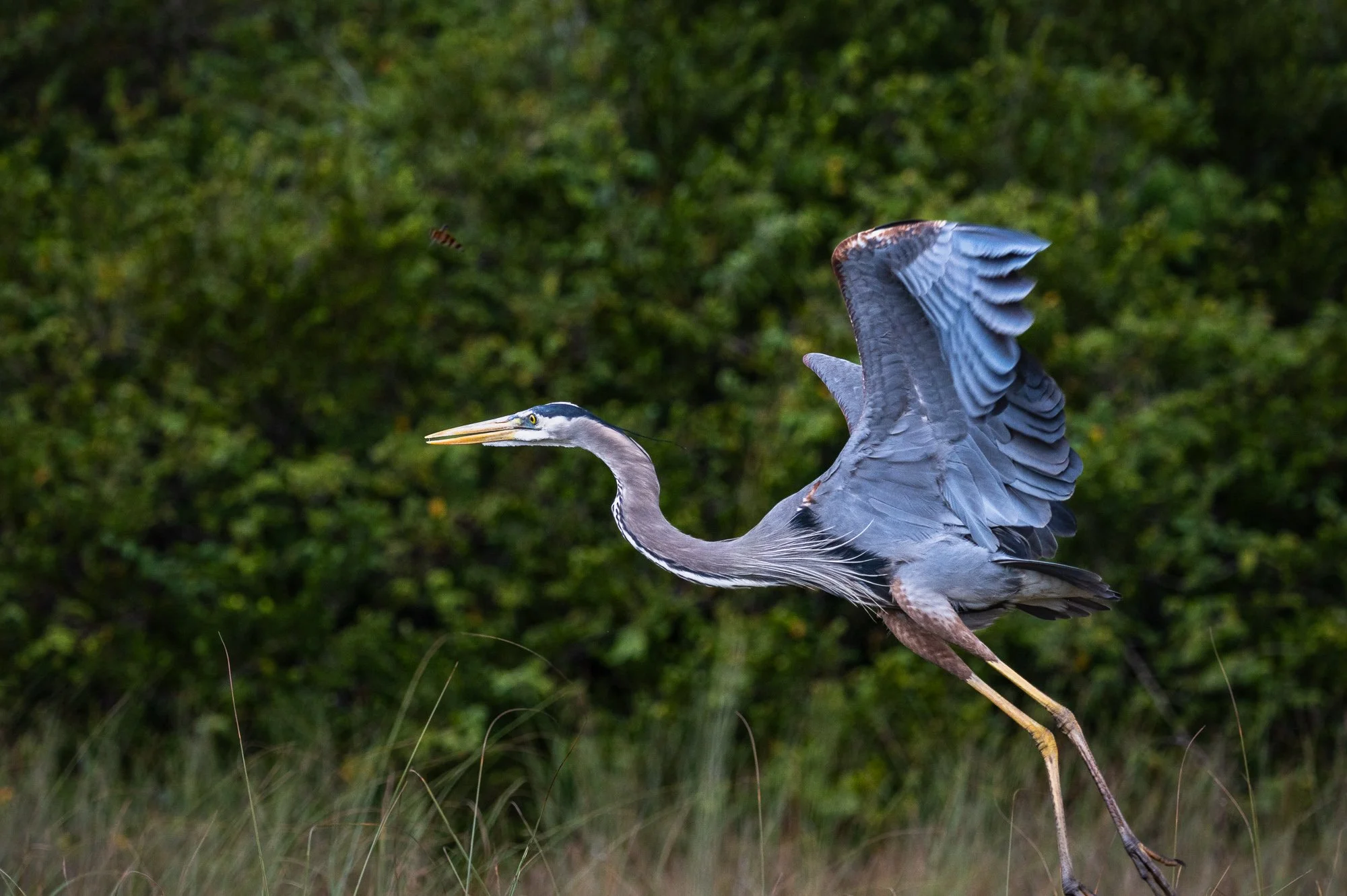
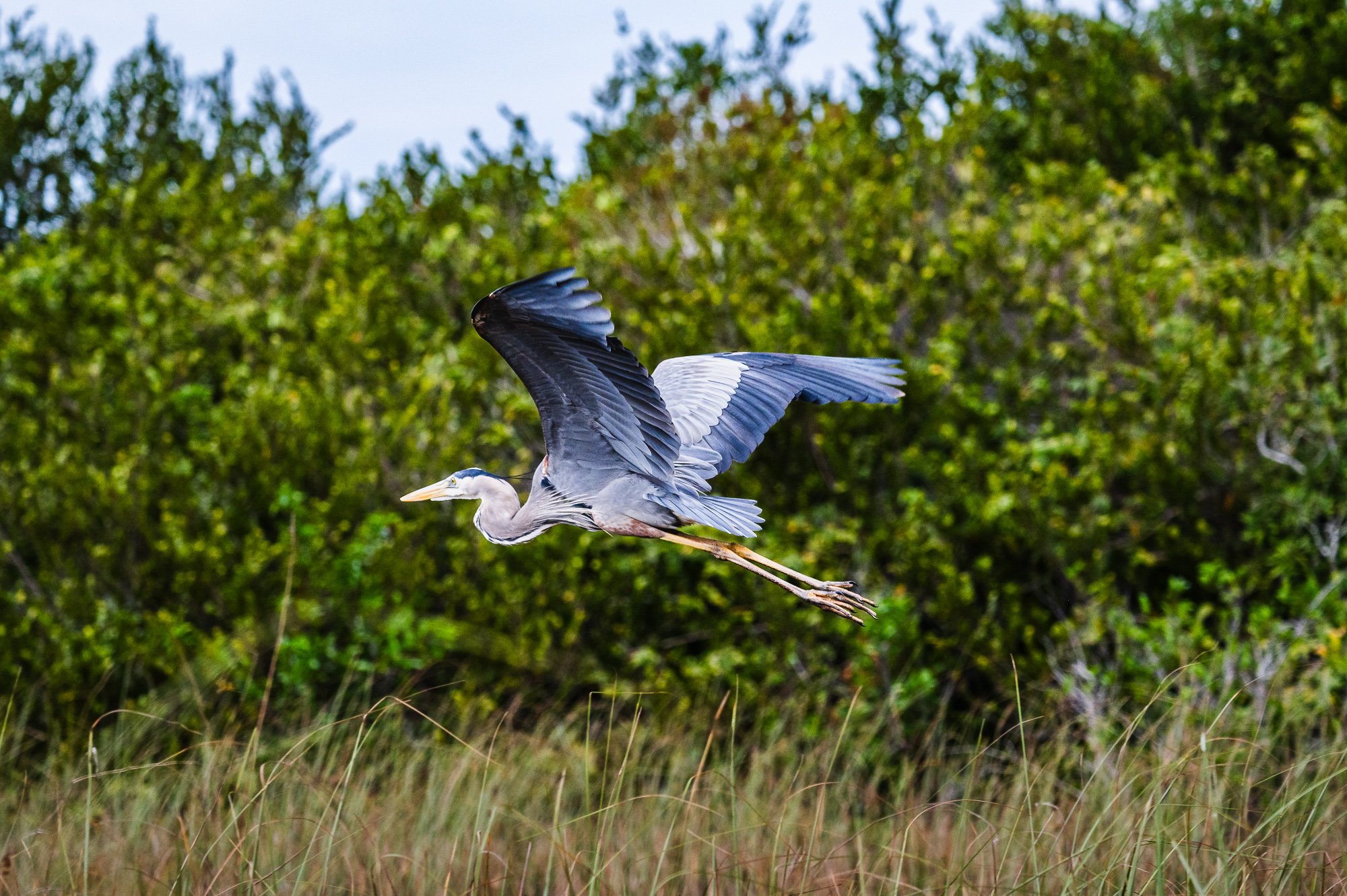
Wildlife


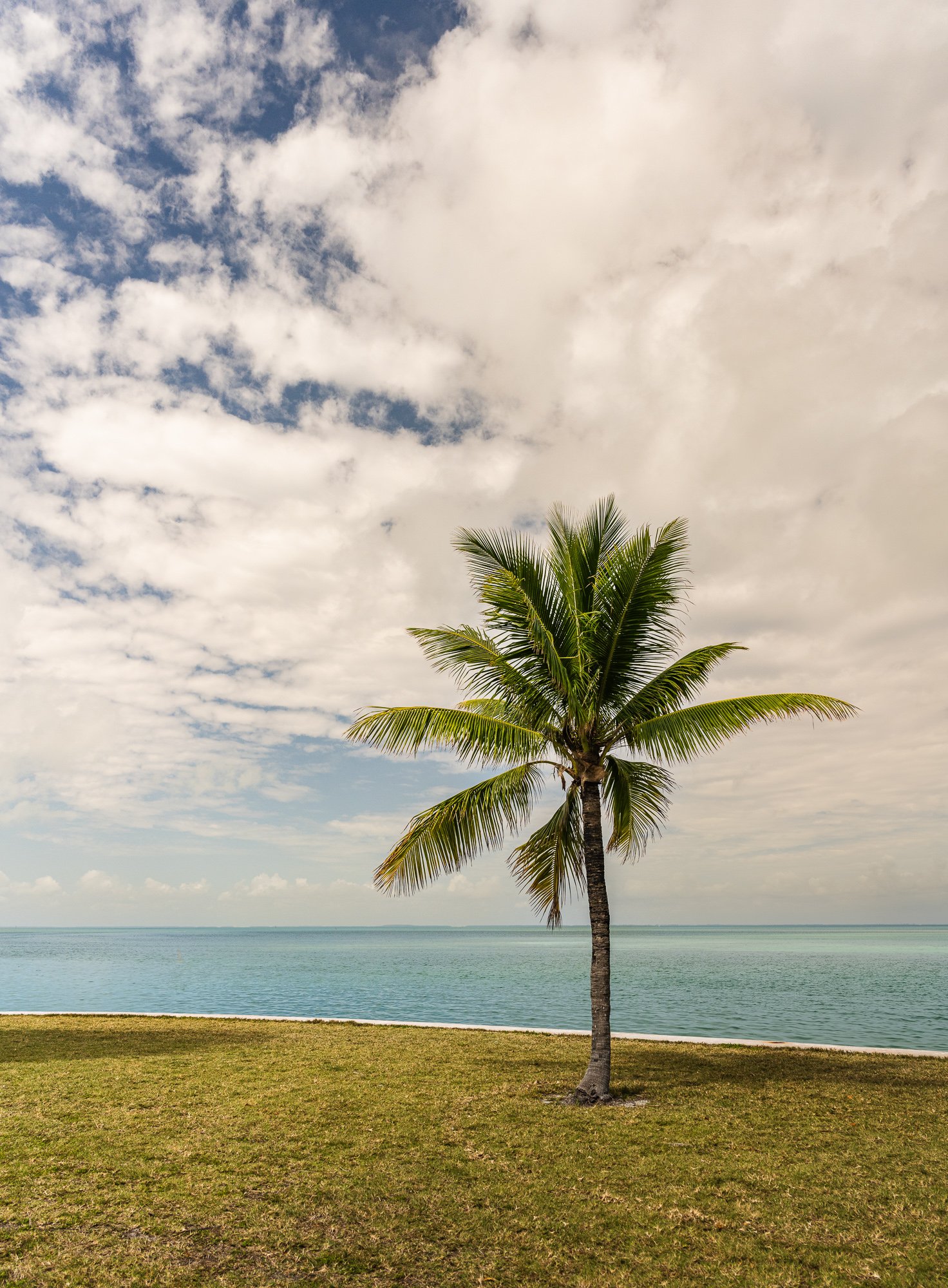


South Beach
After a simple lunch near the dock, we drove to South Beach in the early afternoon. In both daytime and nightfall, South Beach is a major entertainment destination with hundreds of nightclubs, restaurants, boutiques and hotels. i
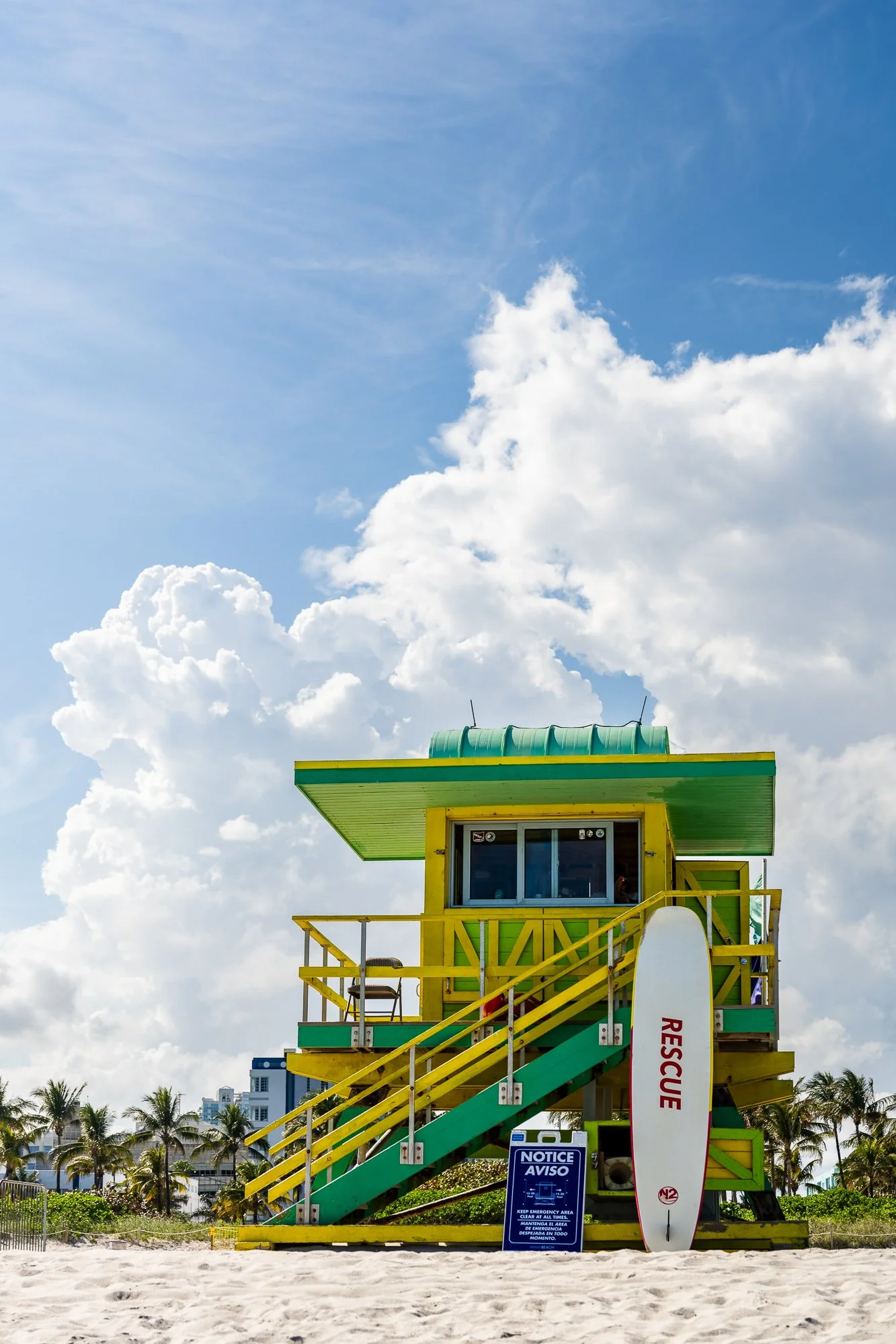
One unique aesthetic attribute of South Beach is the presence of several colorful and unique lifeguard towers. After Hurricane Andrew in 1992, Architect William Lane donated his design services to the city and added new stops on design tours in the form of lifeguard towers. South Beach is considered a hub of LGBT lifestyle.
South Beach is traversed by numerical streets which runs east-west, starting with South Point Drive. It also has 13 principal roads and avenues running north-south, such as Collins Avenue (State Road A1A), Ocean Drive.
In this area, there is a U.S. historic district called Miami Beach Architectural District (also known as Old Miami Beach Historical District or Miami Art Deco District), containing 960 historic building, the largest collection of Art Deco buildings in the world. It is bounced by the Atlantic Ocean to the east, Sixth Street to the South, Alton Road to the west, and the Collins Canal and Dade Boulevard to the north.
Source: Wikipedia


Day 2, March 5, 2024

Florida Keys
The Florida Keys are a coral cay archipelago off the southern coast of Florida, forming the southernmost part of the continental U.S. They begin at the southeast coast of the Florida peninsula, about 15 miles south of Miami, stretching 126 miles south toward Cuba. The islands lie along the Florida Straits, diving the Atlantic Ocean to the east from the Gulf of Mexico to the northwest. Key West is the westernmost of the inhabited island. The uninhabited Dry Tortugas islands, 68 miles west of the Key West, is the westernmost and most isolated of the Florida Keys.
The Overseas Highway (U.S. Highway 1) runs from the mainland to Key West, connecting all of the main islands and is one of the longest overwater roads in the world, with 42 bridges, including Seven Mile Bridge. Completed in 1938, the highway was built over the route of the Florida East Coast Railway, finished in 1912 by financier and developer Henry M. Flagler and destroyed by the 1935 hurricane.
Many of the keys fall within the boundaries of three national parks. Biscayne National Park includes several of the northernmost keys, and most of the keys in Florida Bay are within Everglades National Park. Dry Tortugas National Park, which preserves historic Fort Jefferson, encompasses all of the westernmost Dry Tortugas islands. The keys are protected by the Florida Keys National Marine Sanctuary, established in 1990, which covers an area of some 3,600 square miles. Much of the northern area of the lower keys has been designated the Great White Heron National Wildlife Refuge, and (Big Pine Key) National Key Deer Refuge is located immediately west of Key West.
The Florida Keys are home to a wide variety of plant and animal life. Mangroves, sea grasses, and coral reefs are abundant. Animals such as alligators, sea turtles, and the endangered manatee can be found there, and more than 600 species of fish live in the reefs.
“Key” is derived from the Spanish word Cayo, meaning small island.
Population: 82,874 (2020 census), with 32% is concentrated in Key West.
Reference: Wikipedia, Britannica
We drove through the keys in a single day, starting in the morning from Ft. Lauderdale. Highly suggest against that idea, reason being too much driving and barely anytime to stop and enjoy. We reached Key West in the middle of the day with only one rest stop, then didn’t even spend too much time on the island due to time pressure, heat, and crowd. But there are still some good memories left out of the trip. We made the following stops (by the order of milage from Key West):
Blue Hole/National Key Deer Refuge: Blue Hole is a small freshwater oasis in the middle of the refuge with tons of wildlife such as alligator.
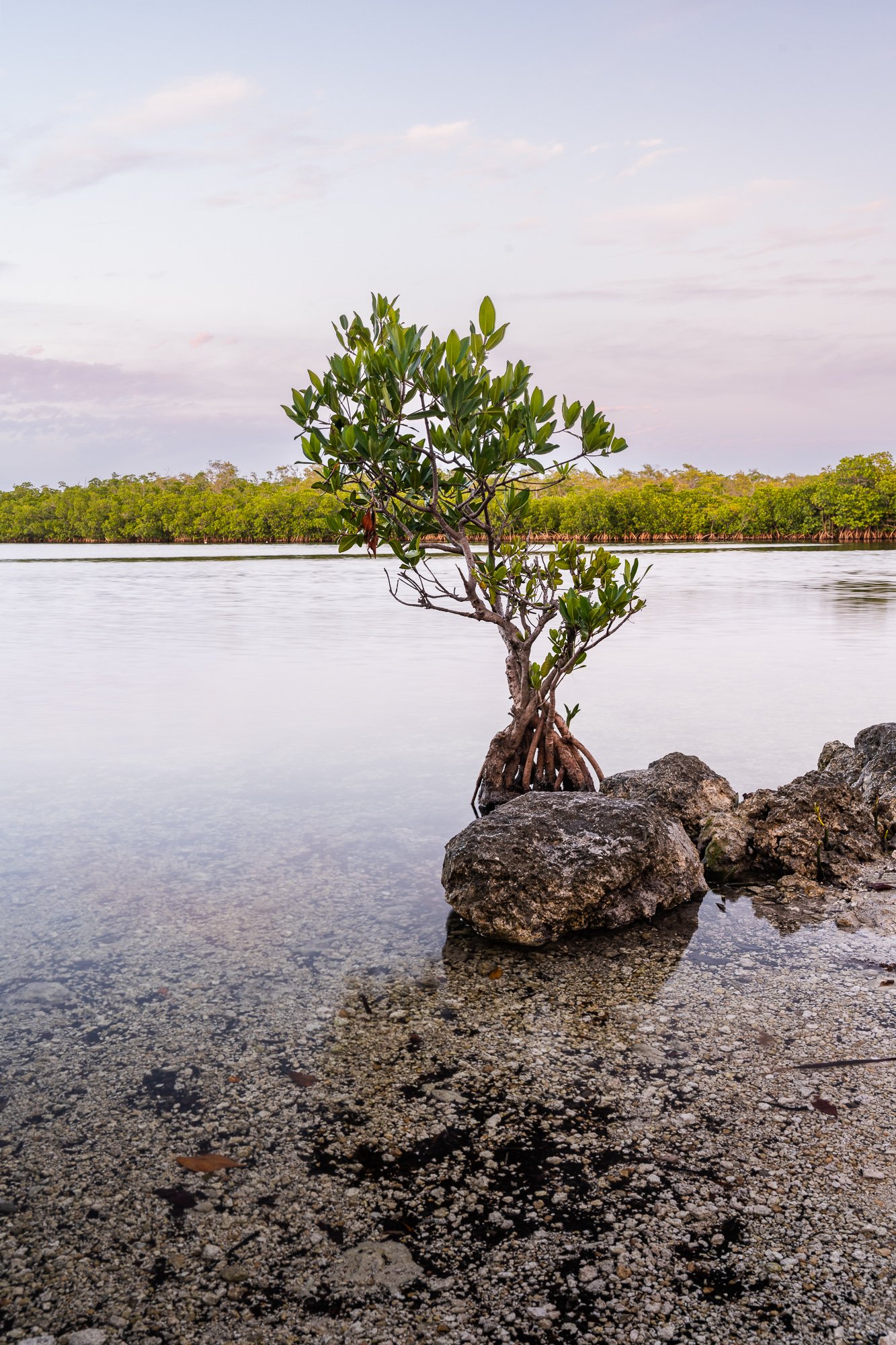
Bahia Honda State Park: small park with great view of the Bahia Honda Bridge, and beautiful beaches.
Seven Mile Bridge - Vista Point on the east side of end of the bridge, which is also the entrance to the parallel pedestrian bridge. That location provides a good view of the driving bridge.
John Peenekamp Coral Reef State Park: last stop before turn north on U.S. 1 back to Miami.


Bahia Honda State Park, Florida
On this Old Bahia Honda Bridge, visitors will find incredible vistas of the sandy beaches and water that many snorkel and swim in. This park covers over 500 acres of pristine beaches and there is a small and beautiful island on the southwest side.
The park’s official website: https://www.floridastateparks.org/BahiaHonda

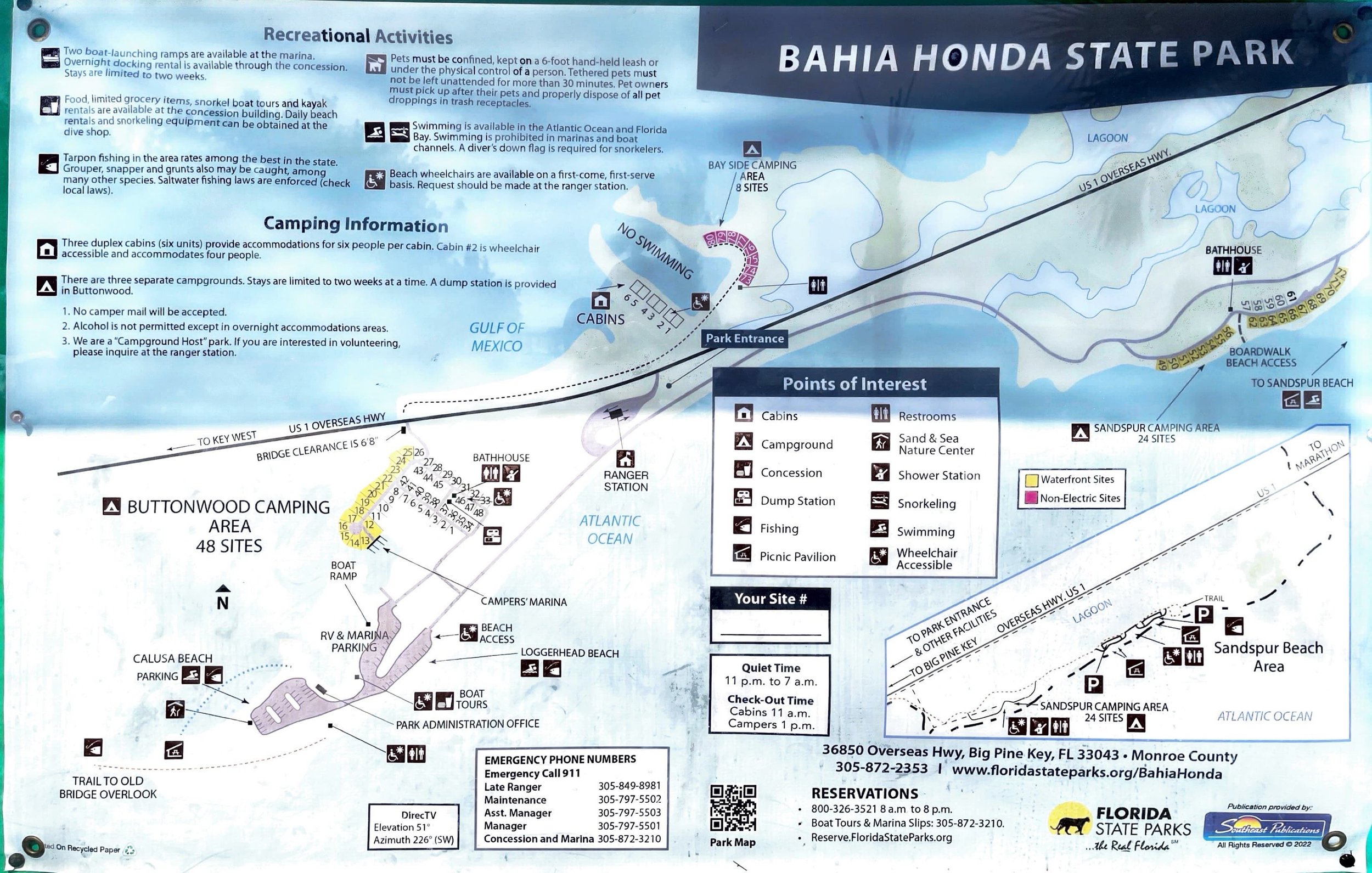

Bahia Honda Bridge Trail
Length: 0.4 miles
Level: Easy
This is the only trail available on AllTrails. We entered the park north bound, and quickly come to the parking lot, which is the start of the trail. We walked up the small hill with bushes on both sides, and on top is the entrance to the Old Bahia Honda Bridge. However the bridge lacks maintenance thus fences off the visitors. After descending the small hill, you can walk either side of the beach with paved roads. From the south tip of the island, you have a great view of the whole bridge. The parking lot has restrooms and shower rooms for beach goers.
If you would like to continue hiking further north section of the park, you can walk along the drive way, which only have two lanes, so be careful of cars passing by. Silver Plan Nature Trail is furthest you can do. Most other parts of the park, including all areas of the other side, are only accessible by water.


National Key Deer Refuge
The National Key Deer Refuge was established in 1957 to protect and preserve the national interest in Key deer and other wildlife resources in the Florida Keys. The Refuge is located in the Lower Florida Keys, consists of approx. 9,200 acres of land. Habitats in the refuge consist of
pine rockland forest
tropical hardwood hammocks
freshwater wetlands
salt marsh wetlands
mangrove forests
It is home to more than 20 endangered and threatened plant and animal species. In addition, thousands of migrating birds pass through each year, stopping over to rest and feed. The refuge is also an important wintering ground for many North America bird species.
The endangered Key deer are the smallest subspecies of white-tailed deer that are found throughout most of North America. Key deer are unique to lower Florida Keys, they are found nowhere else in the world.
Who lives here: Key Deer, Lower Keys Marsh Rabbit, Osprey, Tree Snails, American Alligator, Butterflies
Reference:
https://www.fws.gov/refuge/national-key-deer
Park brochures


Blue Hole
Blue Hole was original excavated for use as a limestone quarry. Many of the original roads on Big Pine Key were built using the crushed limestone from this quarry. When Blue Hole became part of the National Key Deer Refuge, it was replaced with native vegetation and allowed to revert back to nature.
There are literally hundreds of freshwater wetlands like Blue Hole, filled solely by rainwater, spread throughout the Lower Keys.
Blue Hole Nature Trail
Surface: paved, rough in some areas, easy
Length: 225 feet (70 meters) around the southwest side of the Blue Hole.


John Pennekamp Coral Reef State Park, Florida
John Pennekamp Coral Reef State Park is the first undersea park in the u.S. and encompasses approx. 70 nautical square miles. The map you see on the right side is only for the section accessible by car and has visitor amenities and docks. There are several much larger areas in the north mainly ocean and shorelines that are part of the park as well.
Most visitors are drawn to the park to experience the coral reefs and their associated marine life. Many enjoy the view from a glass bottom boat tour, but visitors can get a closer look by scuba diving or snorkeling. Nature walks are available along the Mangrove, Wild Tamarind and Grove trails. Seventeen miles of paddling trails wind through the mangrove swamp. Stand-up paddleboards and kayaks rentals are also available.
The park’s official website: https://www.floridastateparks.org/parks-and-trails/john-pennekamp-coral-reef-state-park

We came to be the park half an hour before the entrance closes at 6PM on our way back to Miami from Key West. As it was very close to the turn onto Route 1, there was a lot of traffic so plan ahead. we only got enough time make a quick stop at Far Beach and then Cannon Beach before it got dark. Don’t underestimate the mosquitos here as my face and neck, the only body park without shield, were full with mosquito bites that didn’t heal until two-three weeks later. I did get a few great photos though because of the light and beautiful plantation in the park. If we could come back again in the future, I think the must-dos include paddling trails and snorkel.


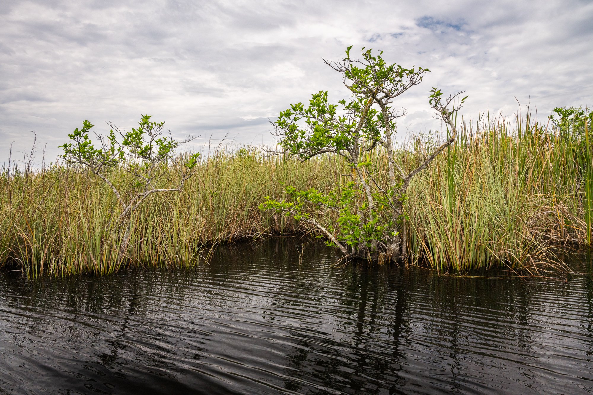
Day 3, March 6, 2024

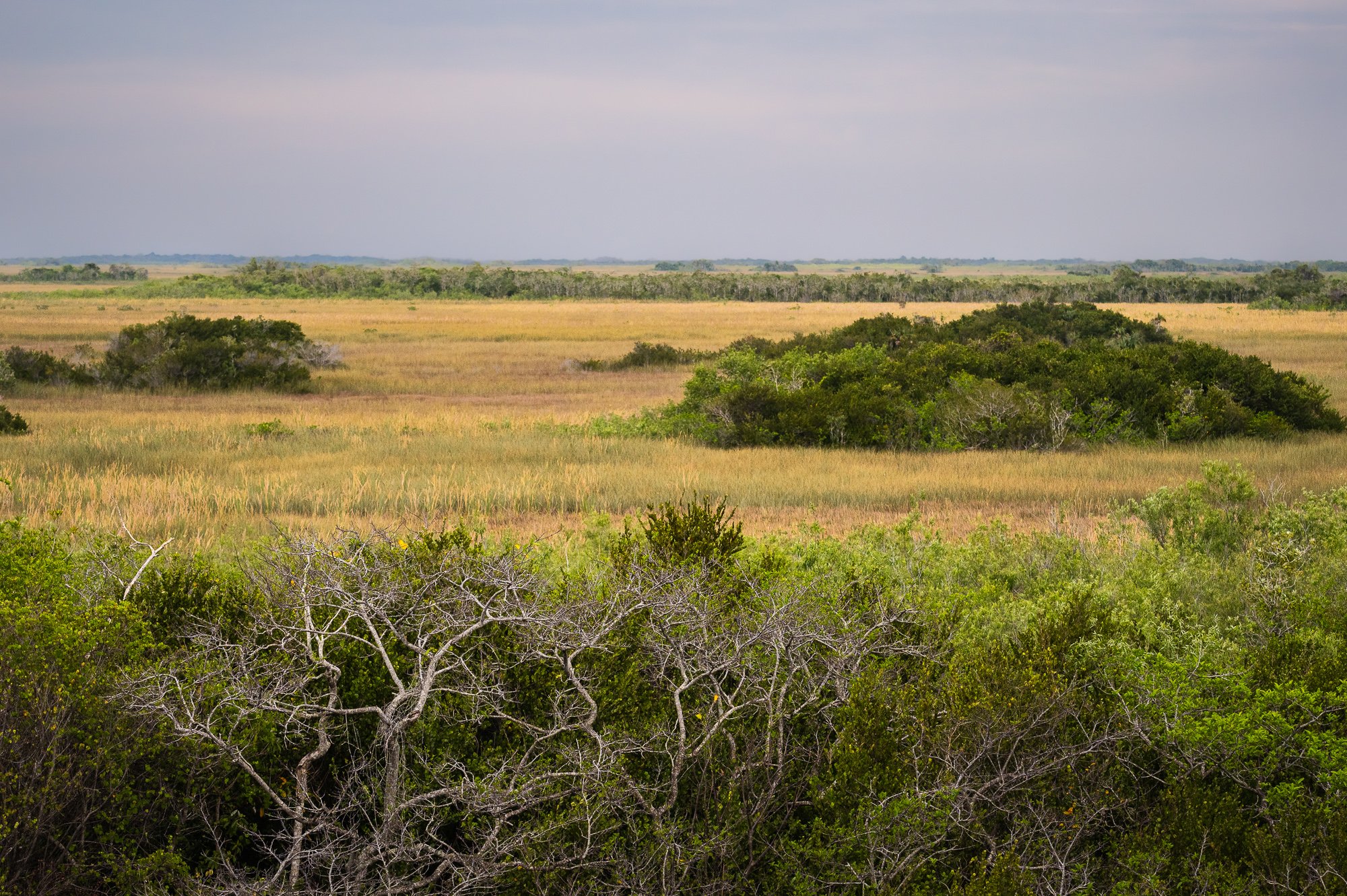
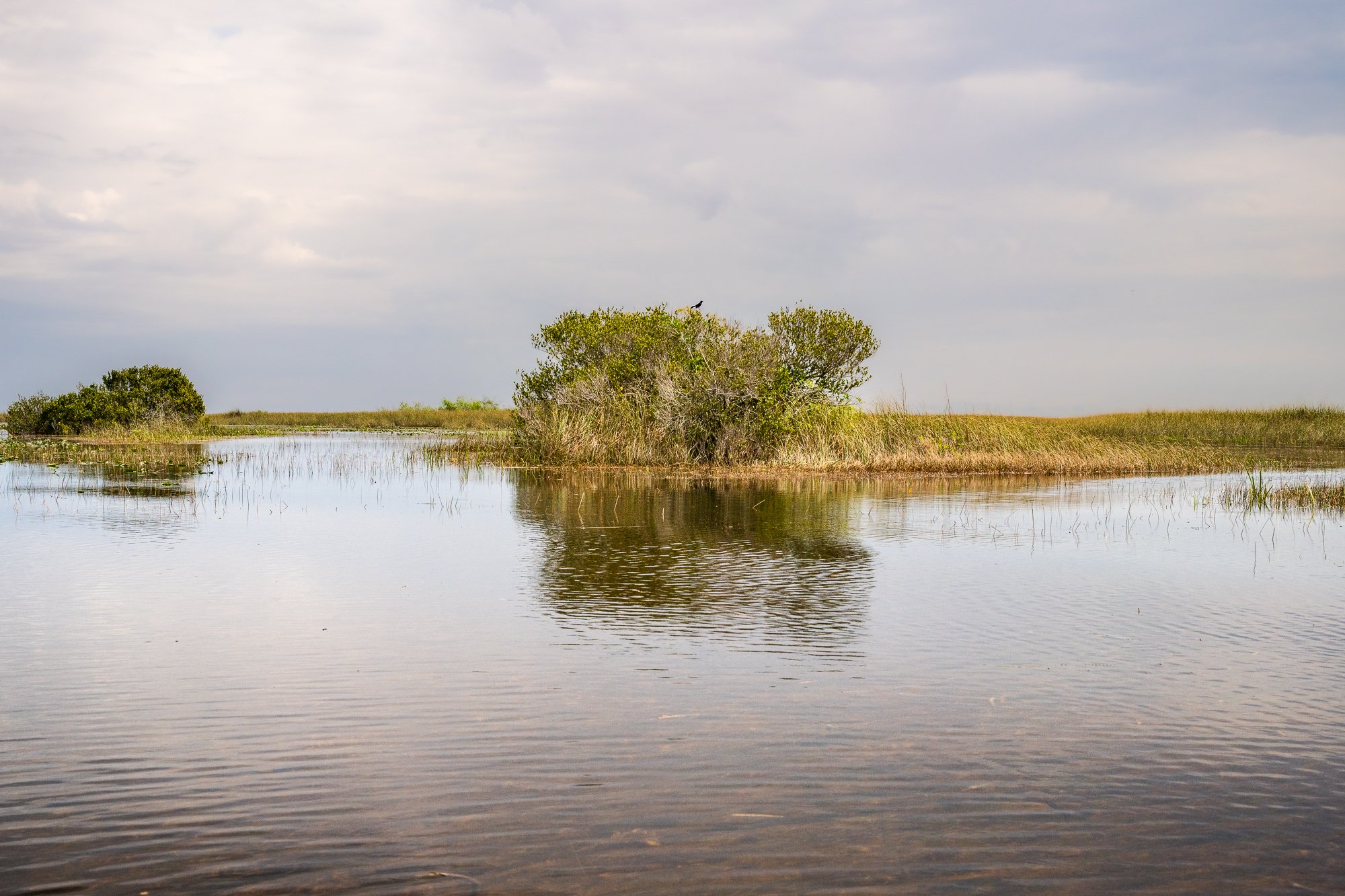
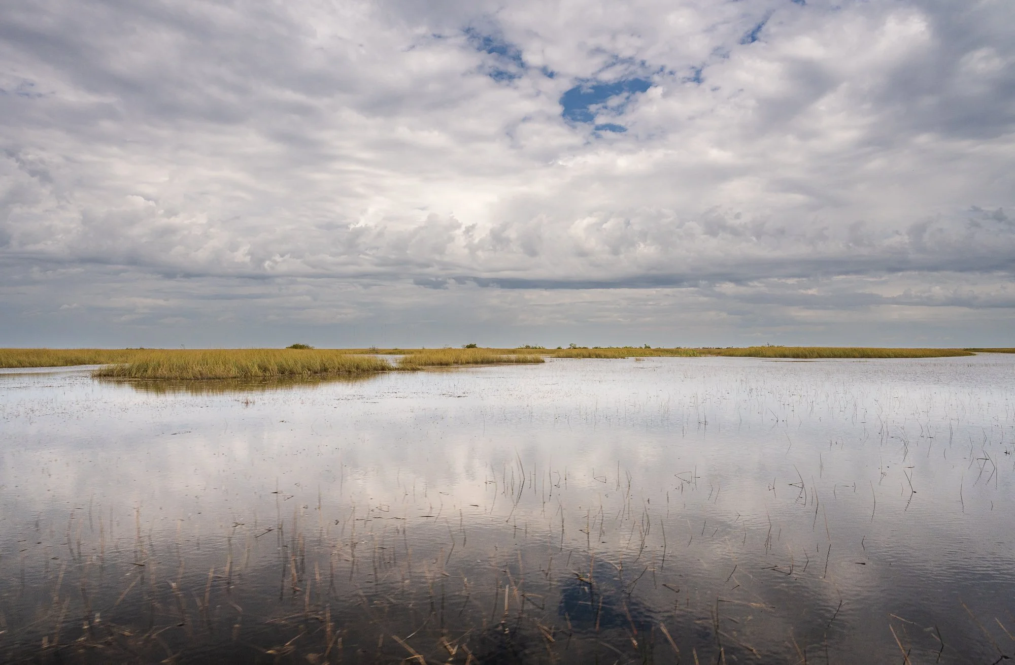
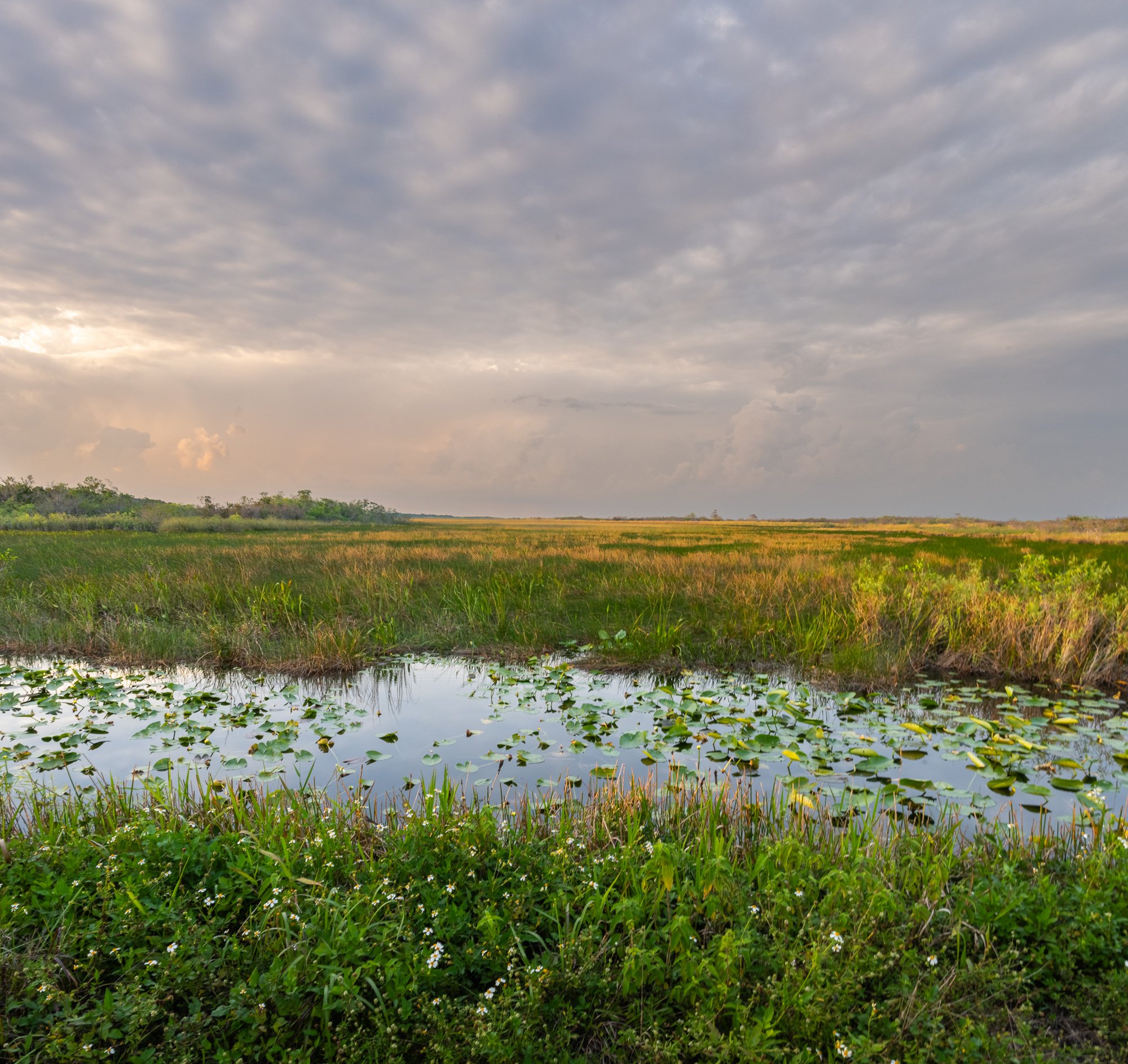
Shark Valley
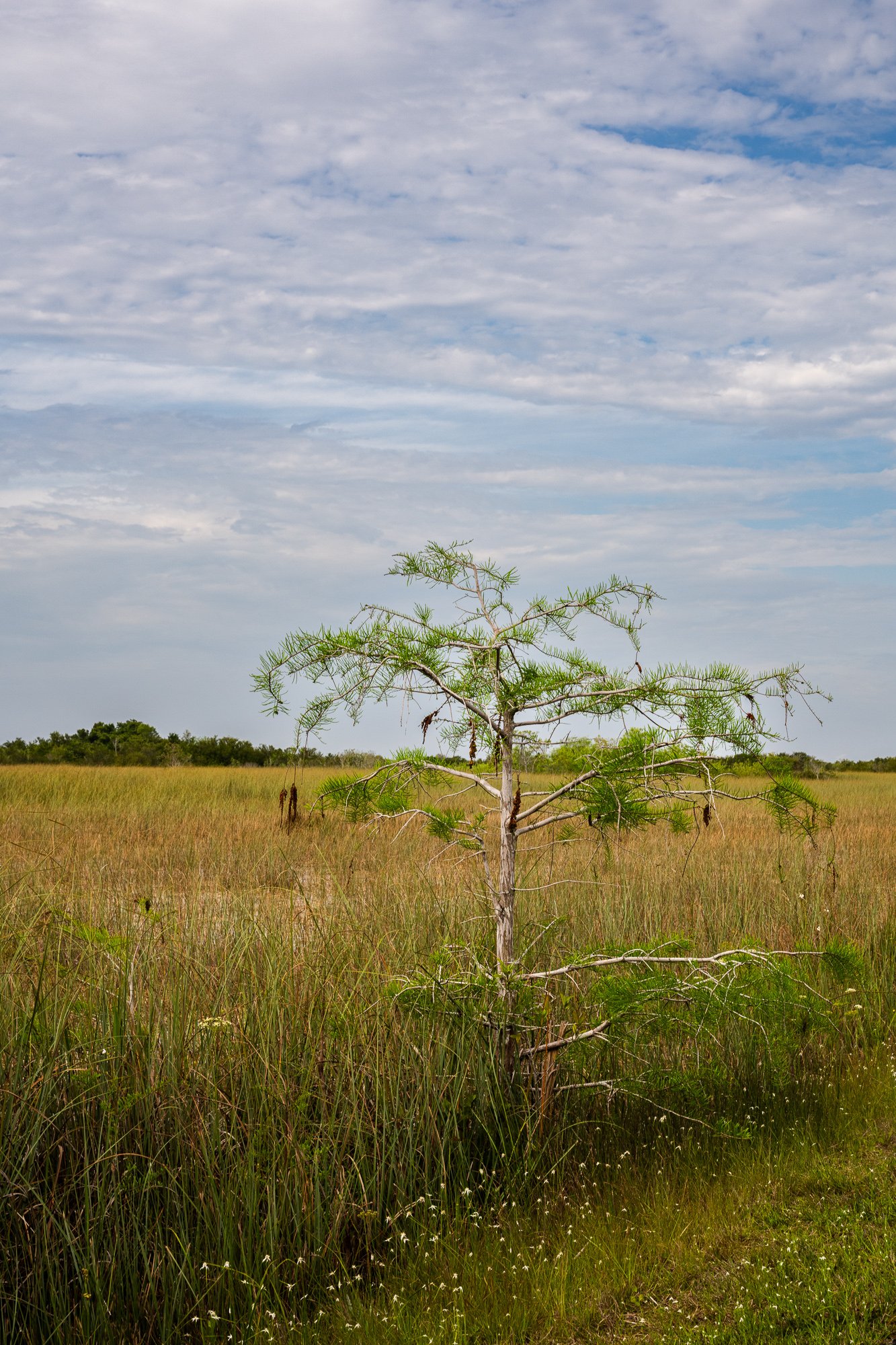
Shark Valley is a 7-mile road that reach the heart of the Everglades, with an observation tower at the end to see the vast sawgrass prairie stretching to the horizons and some of the wildlife that make Everglades famous - alligators and great flocks of wading birds. You can walk, bicycle, or take a tram tour. It is a loop so you will come back on a parallel road.
We took the first tram at 9AM in the morning. The tram is equipped with a driver and guide. The guid explained everything from what we saw, biosphere, wildlife, and history of the park. The tram also made stops when an alligator was identified nearby. We saw alligator hunting turtle twice, pretty cool. The tram would stop at the tower for half hour so the visitors can walk up to the tower for the view.
What wildlife you see at Shark Valley depends on the season. During the dry winter, alligators, wading birds, and deer concentrate near canals and borrow pits not far from the road. also the weather is mild and pleasant in this time, with low humidity and clear skies. In summer, heavy rains fill the Everglades, dispersing wildlife making them harder to see.
At this season, we saw everywhere in the shallow water a ‘ugly’, soft, spongy mat of algae, called periphyton. During the summer rainy season, periphyton floats along the surface, where it is gazed on by fish and tadpoles. During the dry winter months, which is now, animals like snails, crayfish, and insect larvae burrow into its moist interior for survival. So it plays a critical role in the ecosystem here.


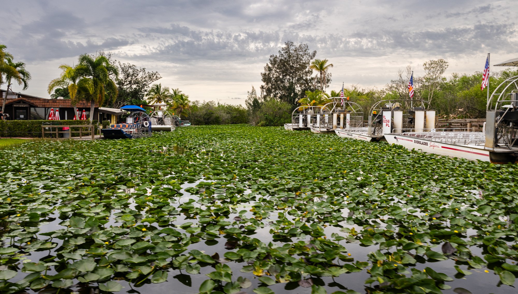
Airboat (Everglades Adventure)
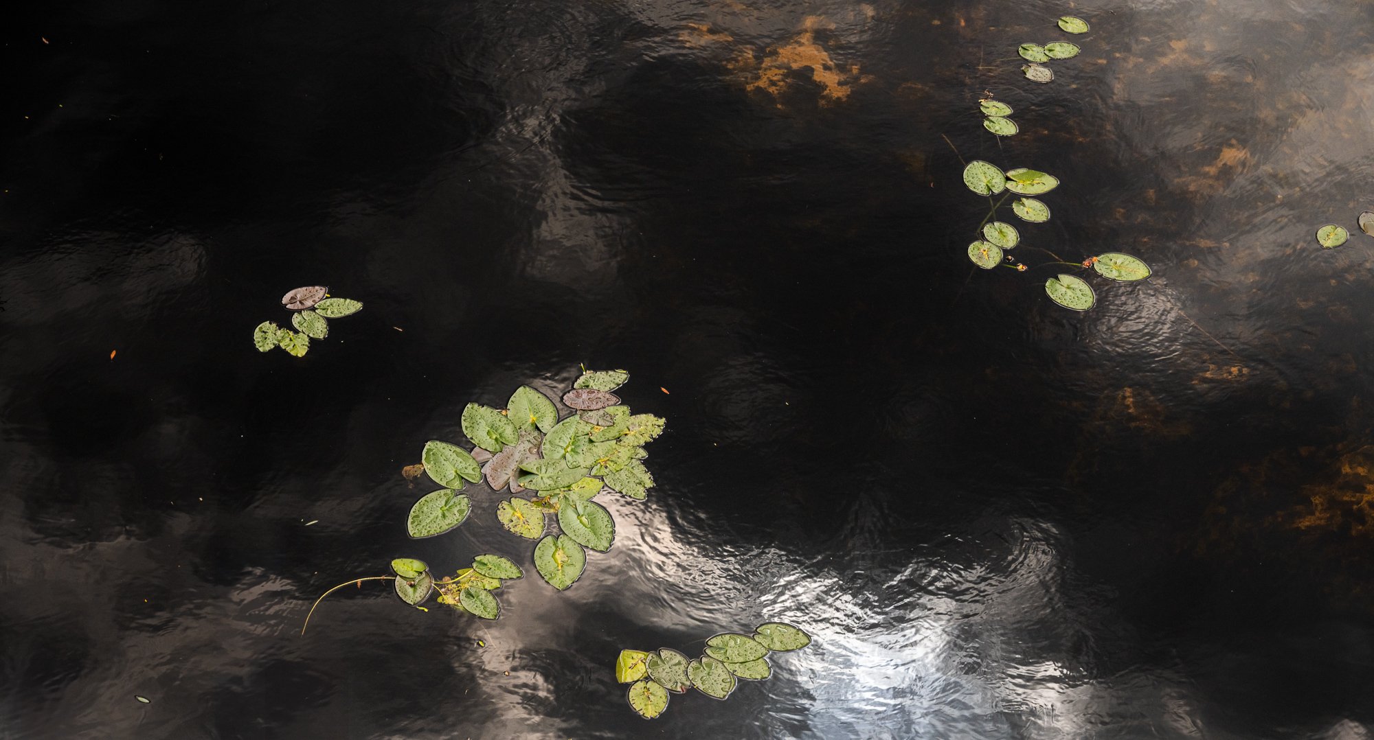
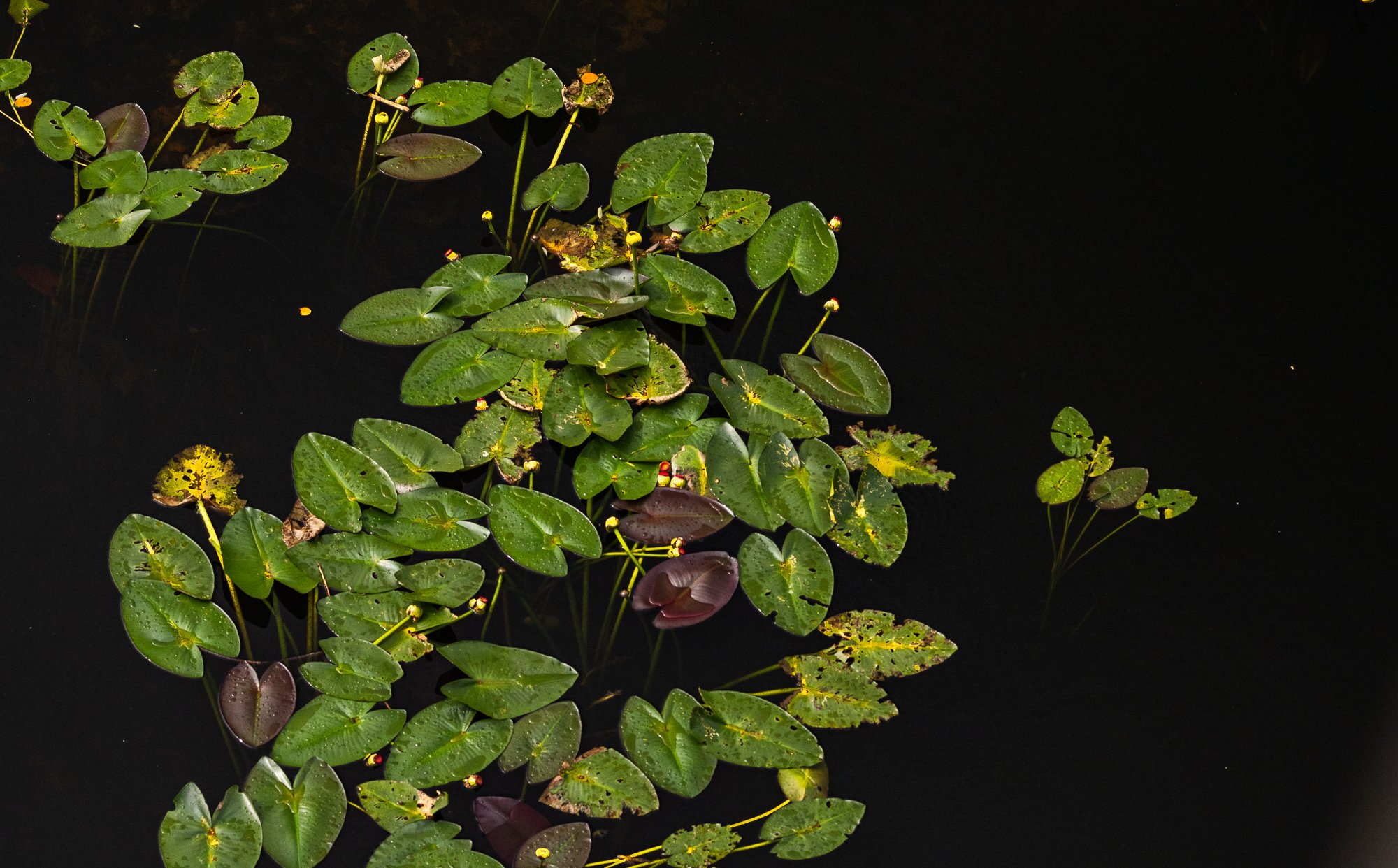
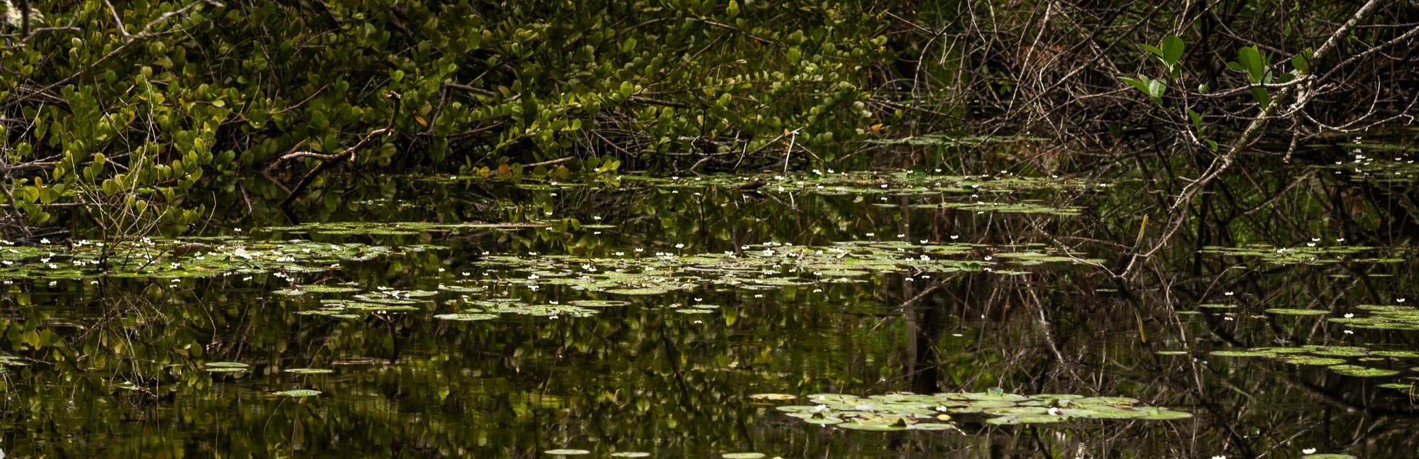
We didn’t make reservation, but didn’t wait long to get on the airboat for an one hour tour. Everyone was given a pair of earplugs to block the engine noise. The boat first cruised through a narrow yellow water-lily packed canal. As the boat is literally floating on the water, not like typical boat using turbine under the water, it wouldn’t cause damage to the plants in the water. Soon we reached an open meadows with grass. We passed by alligators and birds. Didn’t feel the time at all as the scenery was stunning at every turn.
After the boat docked, we were directed to a short alligator “show”. It was more an information session on human raised alligators, and you can pay a small fee to take a photo with a baby alligator. Then you can hike through a small alligator farm at the back.
Afterwards, we had a late lunch at Gator Grill (36650 SW 192nd Ave, Homestead, FL 33034) on our way to the Homestead entrance further down in the south.


Royal Palm (Homestead) Entrance
Originally we planed to drive all the way to Flamingo Entrance but when we were halfway there, we realized that we actually didn’t have enough time to have an in-depth visit of anything if we did that. Thus we changed the plan to focus on several trails near Homestead entrance. Below are sorted by the order of our visit, from south to the north back to the Homestead entrance.
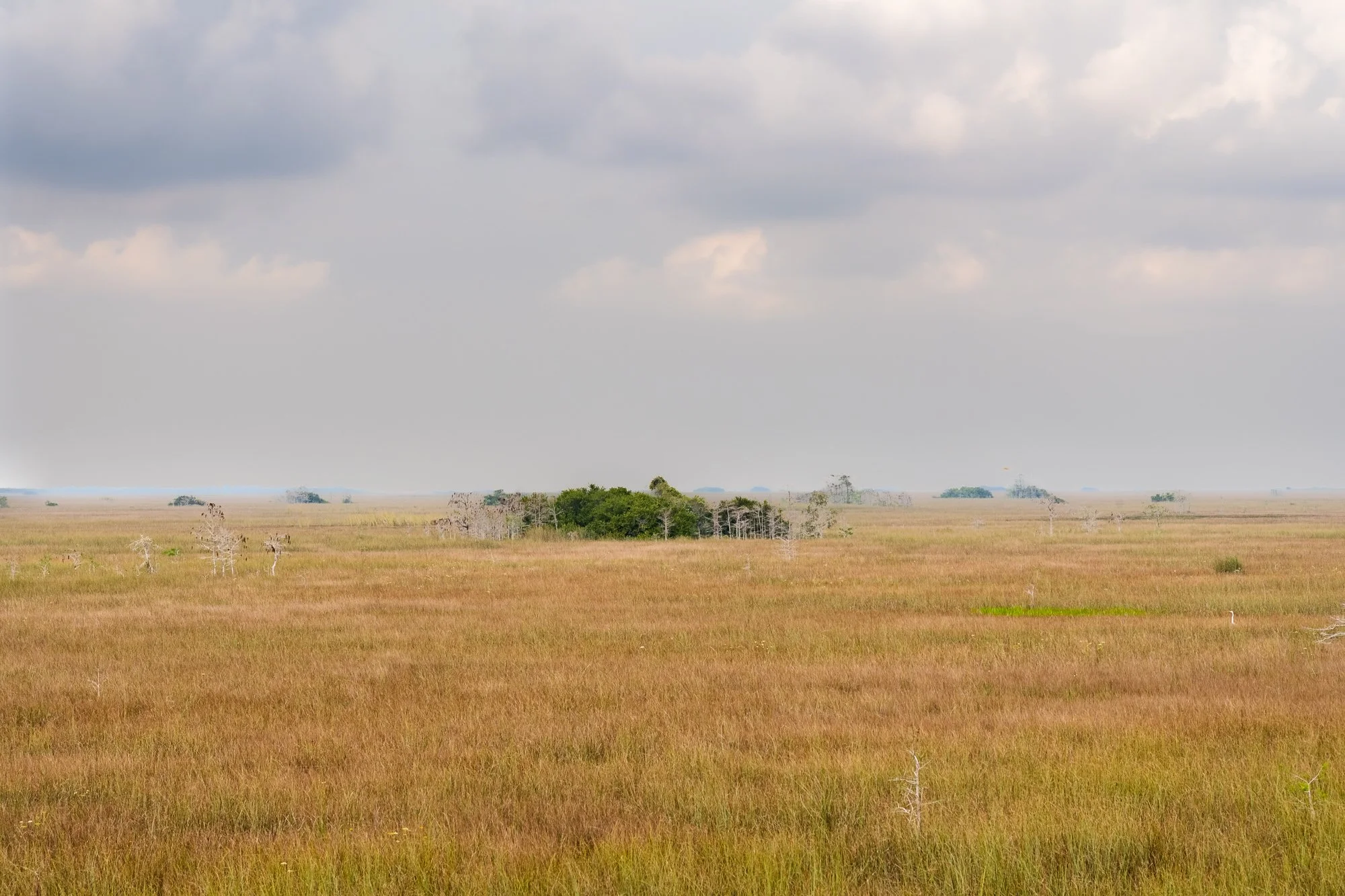
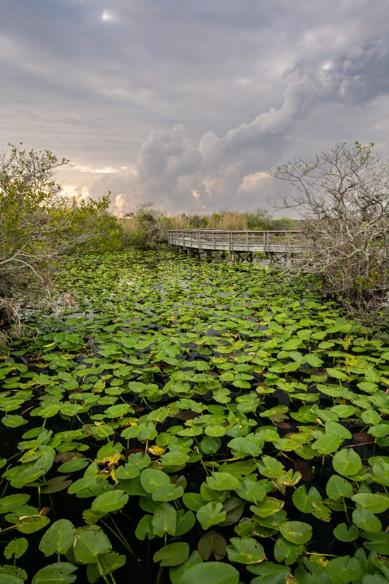
Mahogany Hammock Trail
Mahogany Hammock is an island on the edge of Shark River Slough. The trail is a 0.4 mile boardwalk that goes through the tropical hammock with huge mahogany trees, air plants and other trees.
The island is surrounded by a “hammock moat”, which is a shallow moat encircles most tree island. These watery depression are formed when natural acids from decomposing hammock vegetation erode the surrounding limestone. Moats provide habitat for a verity of aquatic animals and protect hammock trees from approaching fires.


Pay-he-okee Overlook Trail
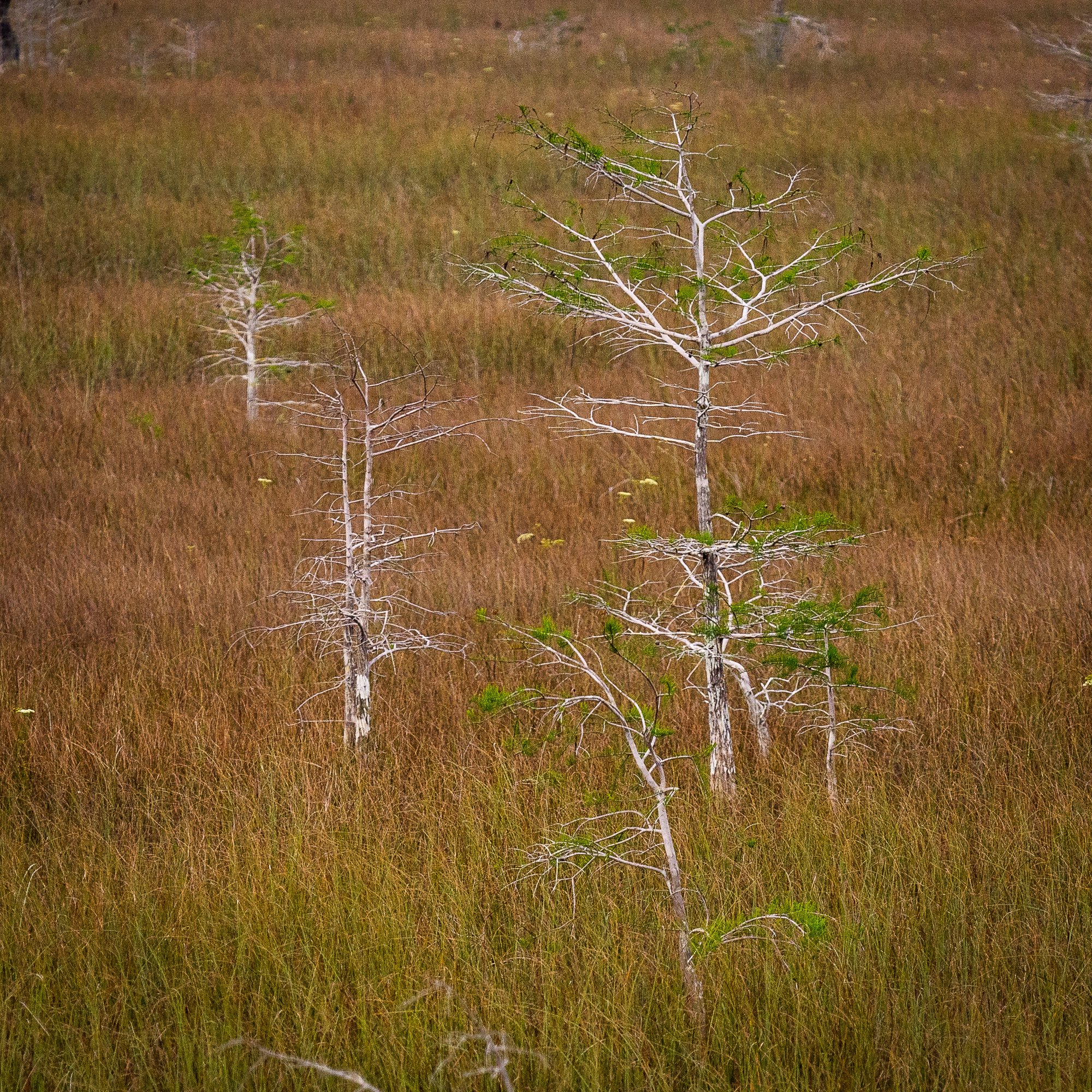
It is a 0.16 miles loop trail on boardwalk. First half of the trail is on top of watery grass. After passing the overlook platform on the top of the small hill, the second half of boardwalk passes through cypress trees in the shallow water.
Pine Glades Lake (Long Pine Key Trail)
It is a small lake not far from the Long Pine Key Nature Trail’s North Trailhead. We didn't have time to hike the trail, so we drove through some large pot holes to the lakeside, and admired the its crystal clear water before getting back on the main park road for the next stop.
For your info, the Long Pine Key Trail is a 6.1 mile one-way trail with bare ground surface. The trail passes through pine dockland habitats, home to a great variety of birds, tropical plants, and the endangered Florida panther. The trail may be muddy after rain.


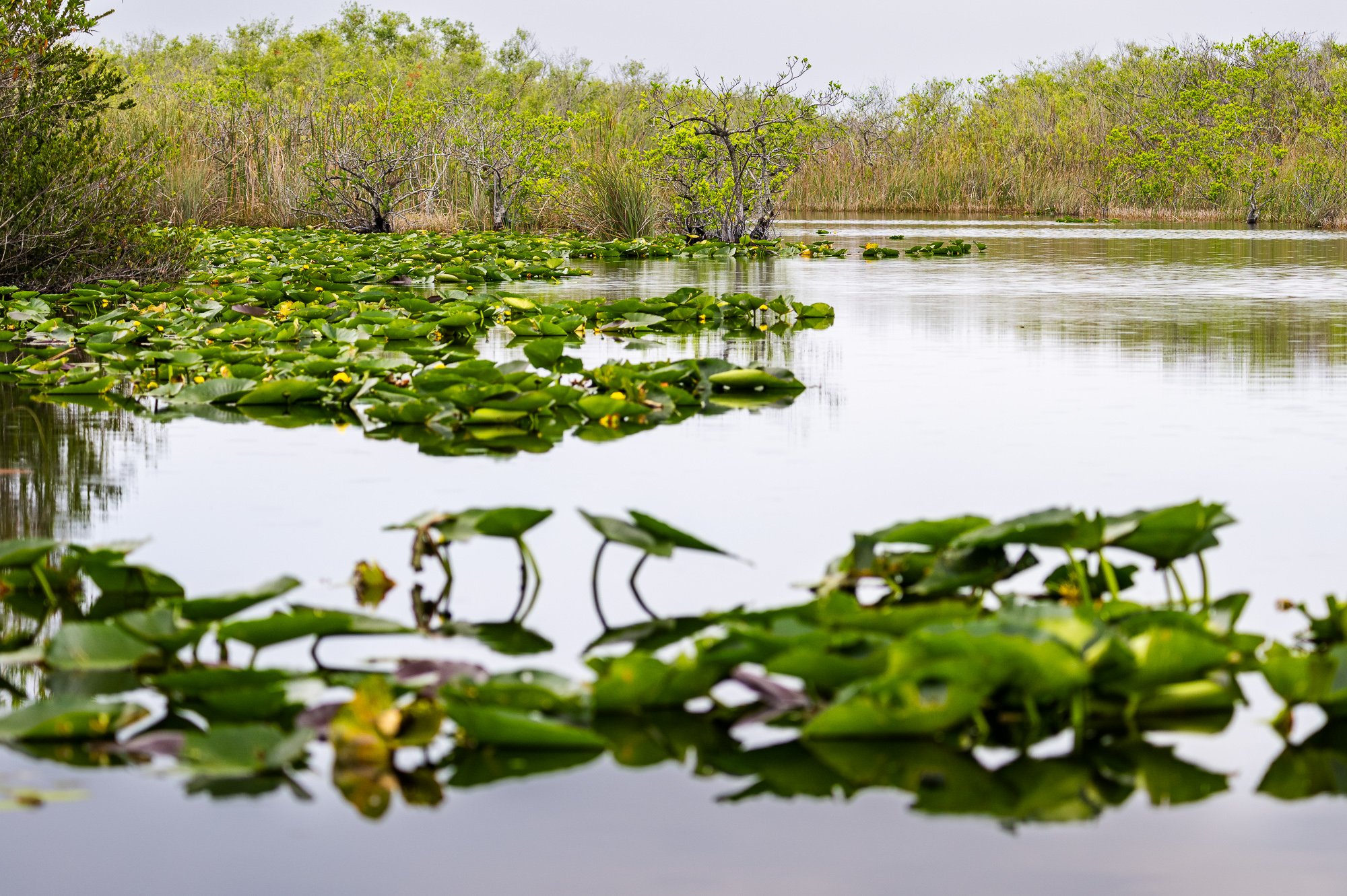
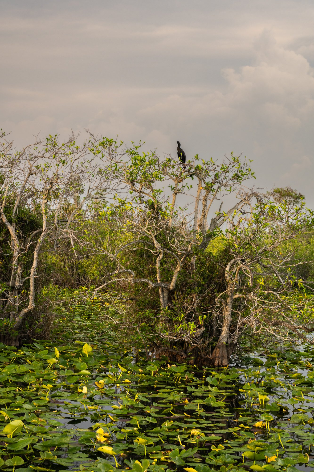
Anhinga Trail
If you have to pick only one trail to hike near this entrance, I would recommend Anhinga Trail. The trail is only 0.8 miles long, but the wildlife is unbelievably abundant here!
After we parked near Royal Palm Visitor Center, we stopped by the Borrow Pit and noticed right away in the corner of the pond, a colorful Purple Gallinule stepping from one water lily leaf to another picking the buds for food. Since I only got a glimpse of the Purple Gallinule on the moving tram at Shark Valley earlier, not sure whether I captured it well on camera, I was surely exhilarated to have the luxury to take plenty of photos of this bird at the near distance. Then we identified an alligator floating on the surface with both head, back, and tail floating on the clear water. When we moved on, and we noticed another Purple Gallinule!
After passing the Pond Apple Willow Marsh, we came to the Anhinga nesting area on the boardwalk. Several Anhinga rested on the roof of the shelter drying up their wings, as they dive deep water for fish. Then we identified a few more Purple Gallinules, two of which were fighting for territories! Then the rain retreated and came out this beautiful sunset with soft clouds in the sky.
Later I learned that these wildlife encounters in this area is not random. This trail skirts the edge of a freshwater slough. During dry season the slough operates like one of the many gator holes throughout the shallow river of grass. In these deep pools, fish became concentrated, attracting alligators, wading birds, and a throng off other creatures.
Gumbo Limbo Trail
Unfortunately we didn’t have enough time left to hike on the Gumbo Limbo Trail, which is a short 0.4-mile paved loop trail on the other side from the visiting center. Here is some information from the park for your reference:
The trail tunnels through a tropical hardwood hammock, a world dramatically different from the wide-open slough. In the shadowy tangle of vegetation, the plants at first appear all alike and the wildlife non-existent. But the hammock contains a surprising variety of species that take unfamiliar forms. In the intense competition for light and space, the vegetation grows in layers.


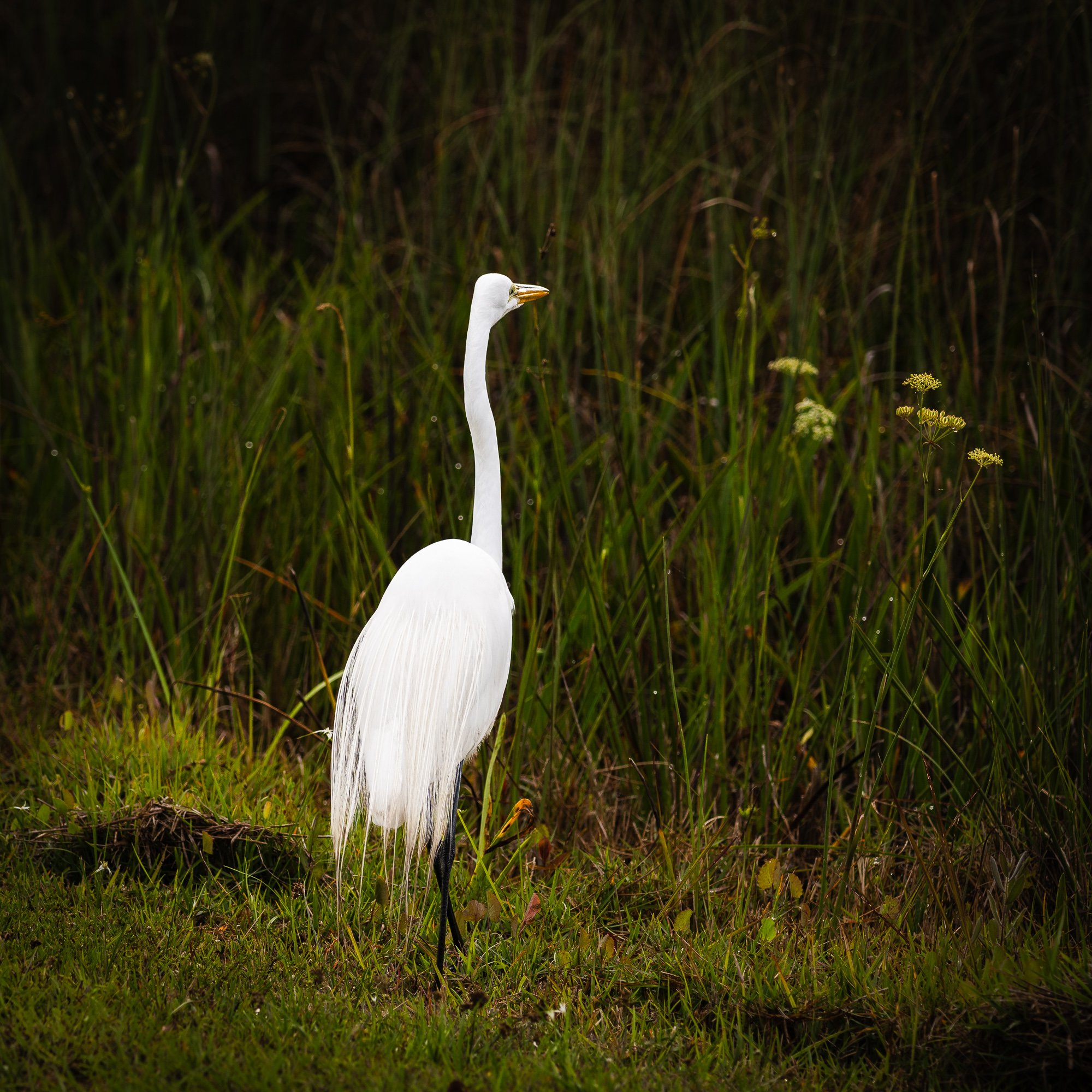
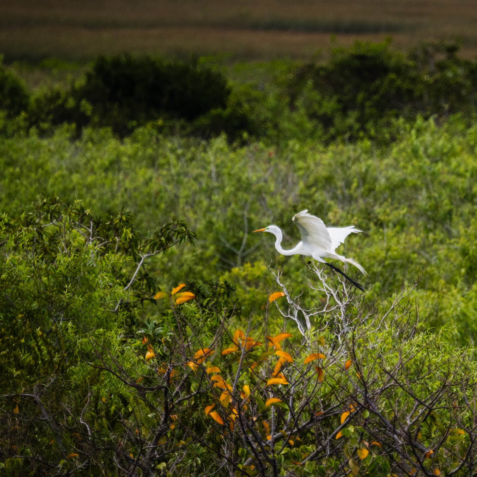
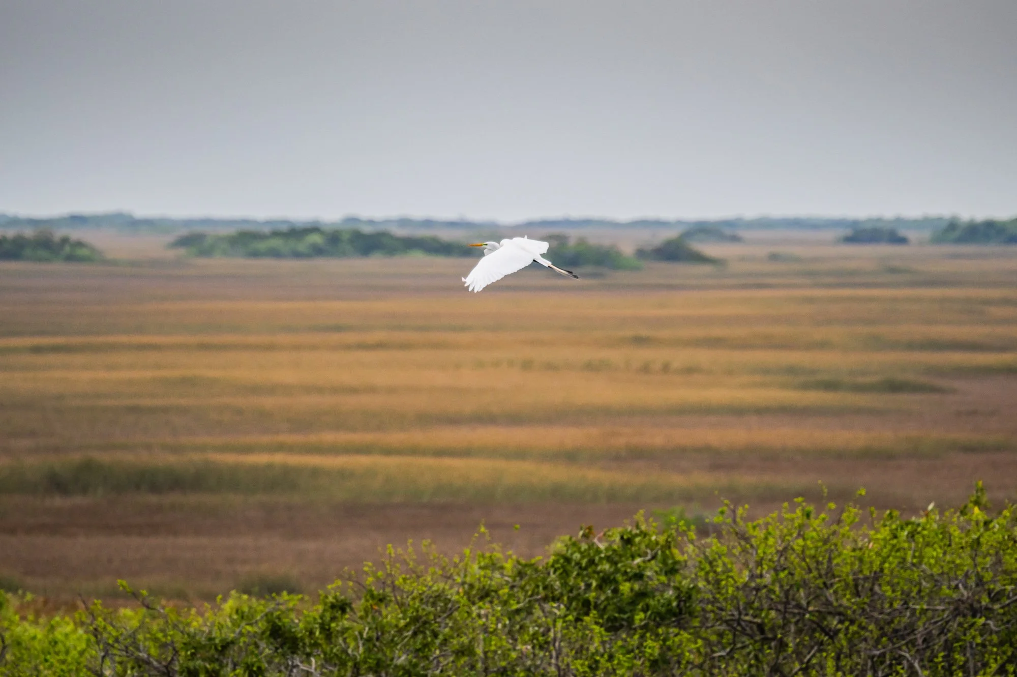
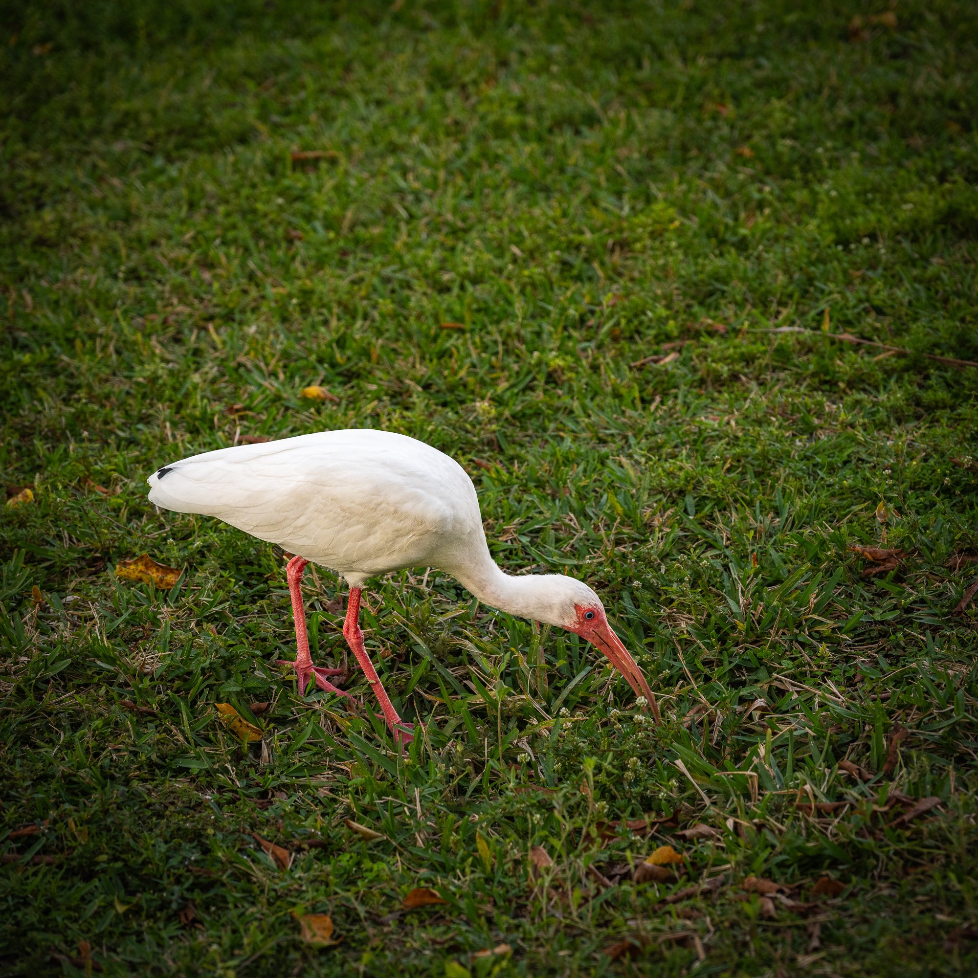
Wildlife @ Everglades


Day 4, March 7, 2024
Design District
Design District is a vibrant and luxury shopping and arts destination.
Spanning 18 square blocks north of the Wynwood neighborhood, the area is an international destination for fashion, galleries, architecture, public arts, and fine dining.
Official website: https://www.miamidesigndistrict.com


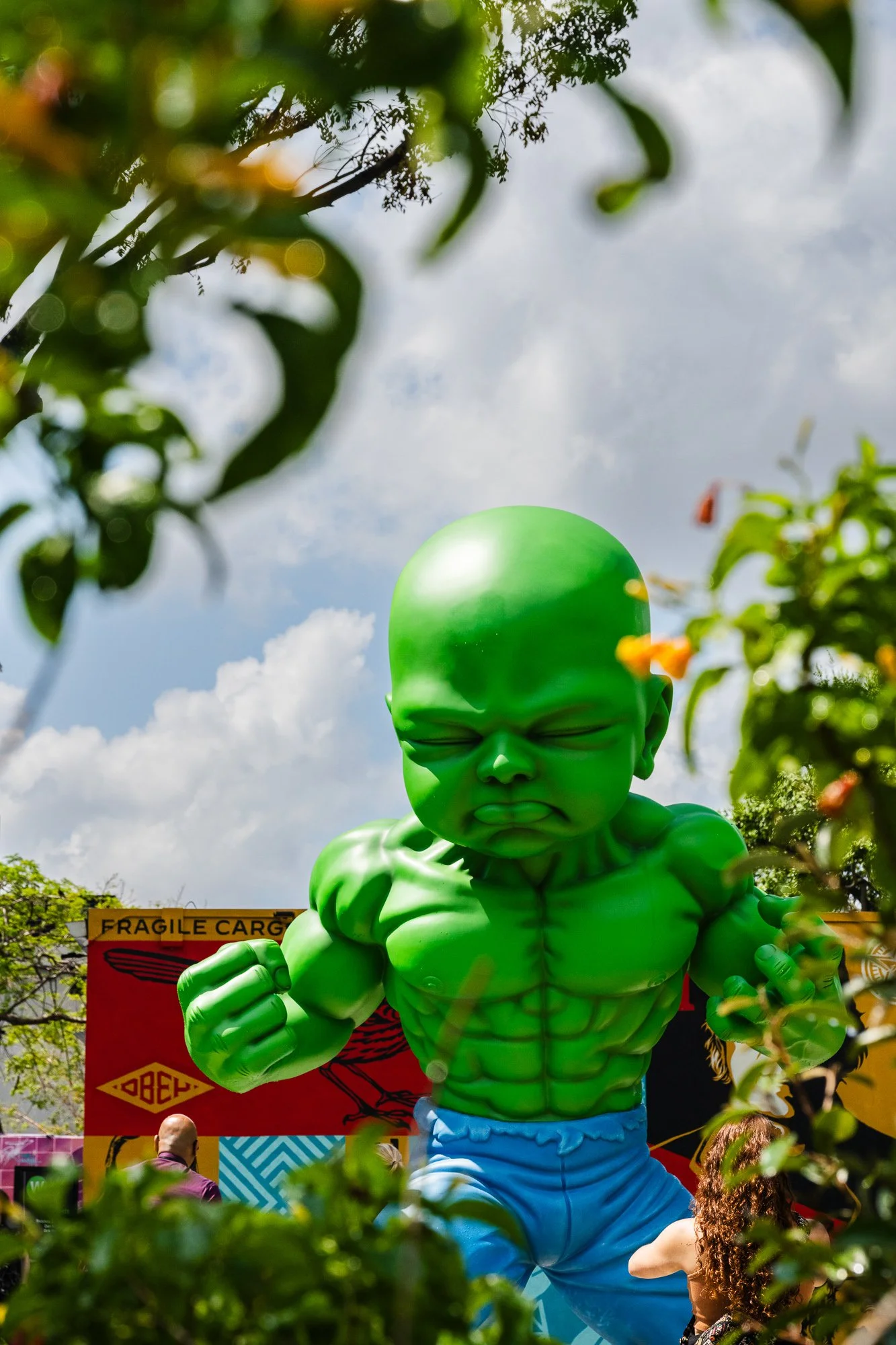
Wynwood
Wynwood is bounded by the Design District on the South side, and sits just north of Downtown Miami.
It is home to craft breweries, authentic Puerto Rican cuisine, and dozens of nightclubs, making it one of the busiest area of the city after sunset. We are here mainly for another famous feature of the area - street art. The streets in this area are an ever-changing tapestry of murals by renowned local, national and international street artists.
The outdoor museum Wynwood Walls (https://thewynwoodwalls.com), dedicated to street art, was opened in 2009 and sits in the center of district.
-Tripadvisor


Little Havana
Little Havana, just west of Downtown Miami, is a community with a thriving Cuban arts and cultral heritage.
The neighborhood is centered around Calle Ocho, or SW 8th Street , as the locals call it in Spanish. Here you will find bakeries, coffee, restaurants, cigar shops.
The famed Domino Park is where neighborhood old timers gather to play dominos and talk politics.
We had our lunch here at El Pub Restaurant and cuban sandwich is a must-have on the table. The restaurant sits cross from the street from the Little Havana Visit Center, and has two huge rooster statues right in front of the entrance.
We also stopped at Azucar Ice Cream Company. You won’t miss the ice Cream parlor on the street as the facade has an enormous ice cream cone piled high with colorful scoops. The sho chorus out over 100 flavors made with all-natural ingredients.


Hugh Taylor Birch State Park, Florida
We made this park our last stop for our spring break visit of the area, before catching our flight in the Fort Lauderdale airport later in the evening. By the time we got there in the mid of the afternoon, it was raining cats and dogs. So we drove around the park a few rounds to find a shelter. It took about 10 minutes nonstop to finish the driveway loop. When the rain stopped about 30 minutes later, we noticed the huge Banyan tree on the side. It was gorgeous. We then drove, before we realized there is a crosswalk from the park, and found a parking spot on A1A, and stayed on the beach for a while, feeding seagulls and watching the romantic Florida sunset before heading to the airport. A perfect way to conclude our spring break trip.
Hugh Taylor Birth State Park was the “Central Park” to Fort Lauderdale, and was gifted to the city by Hugh Taylor Birch, from whom the urban oasis is named.
The park can be access by car or by boat from the intracoastal waterway. Visitors can access the beach from the park via the crosswalk on A1A.
The park’s official website: https://www.floridastateparks.org/HughTaylorBirch