Canada Icefields Parkway
May 31 & June 3, 2024
Introduction
The Icefield Parkway (highway 93) connects Banff with the Town of Jasper. It is one of the most beautiful scenic highways in the world. A national park pass is required for all travel on this scenic parkway.
We departed from Mount Revelstoke National Park on Friday May 31st, 2024 in the morning. Then from Banff north bound and arrived at Jasper before dark same day. After spent a few days in Jasper National Park, we drove south bound on Monday June 3rd along the Parkway and back at Banff by the evening. There were still so many sites that we were not able to hit due to the limitation of time.
This is absolutely THE most beautiful scenic highway we have ever experienced. You need to plan carefully ahead of time on what you must visit, what you may include if you have room in your schedule, and what you may have to miss and save for later. There are so many beautiful spots to explore and experience along the parkway. You also need to consider the season as some sites might be closed due to snow or forest fires. Hope our itinerary below can be helpful.
The order of these locations is from south to north, but actual visits were on two different dates. I also did not include any sites in either Banff of Jasper National Park, as those are covered in the posts about the parks:
Map

https://parks.canada.ca/pn-np/ab/banff/visit/les10-top10/glaciers-icefields
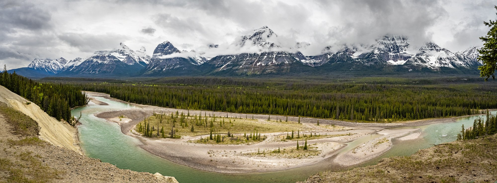
Drove: Mount Revelstoke - Banff - Bow Lake
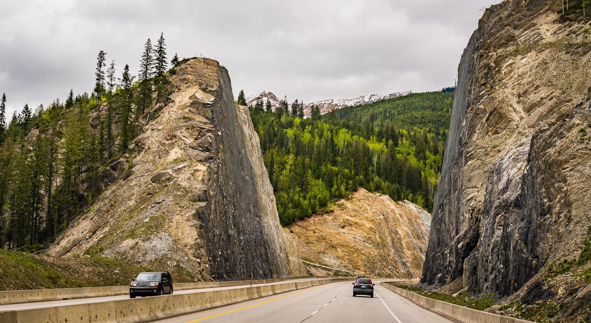
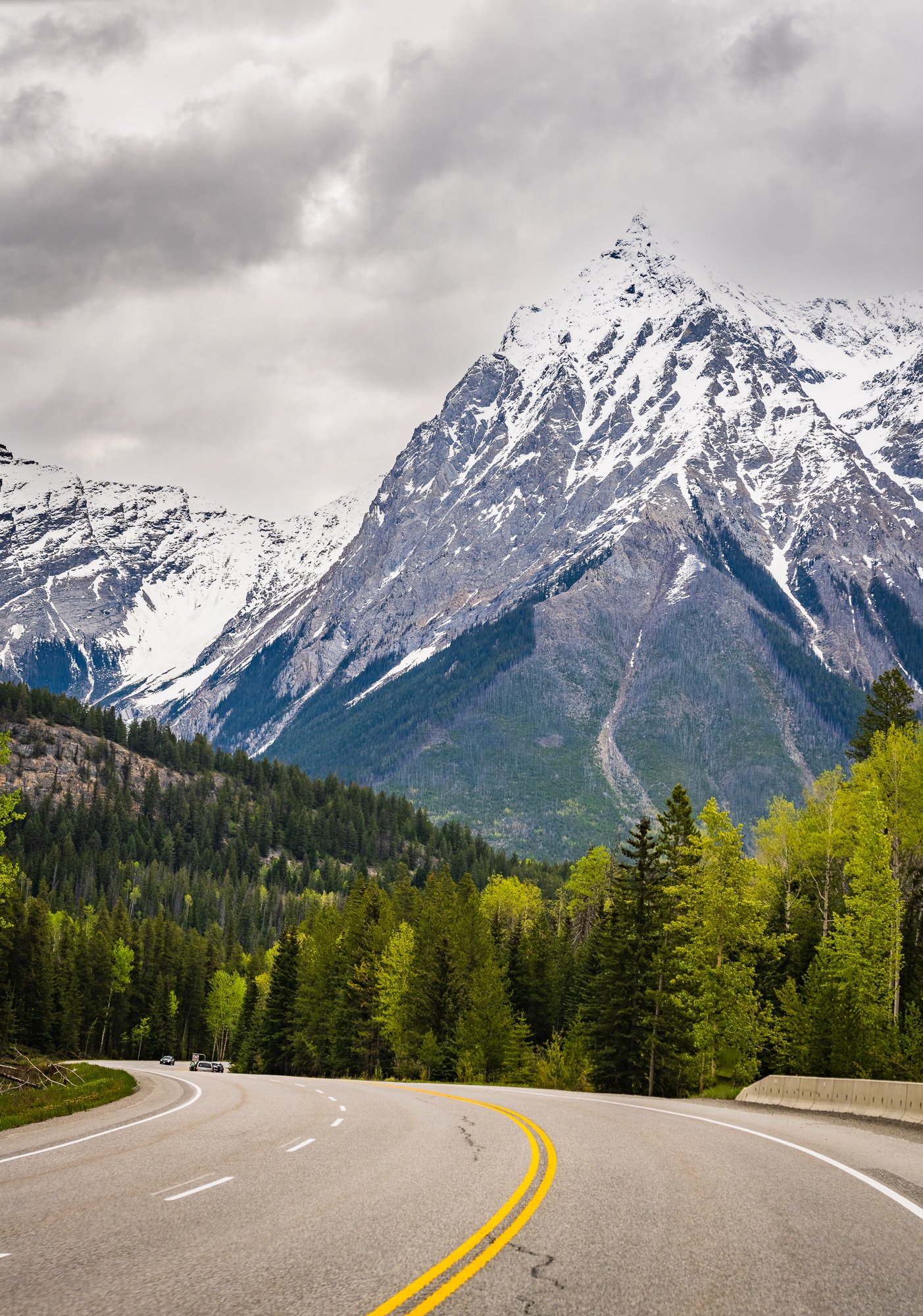
We started very early in the morning from Mount Revelstoket on May 31, 2024. The road was very empty before Banff with low clouds and mists. It even snowed briefly when we got Banff, but soon turned sunny when we are in town of Banff.
By the time we were close to Bow Lake in the late morning, the mountains outside of the window turn much more grandeur. That’s because of these are the skirts of the Icefields. These peaks of different shapes and angles last the whole trip on either or sometime both sides of the R


Hurbet Lake
This was actually the last stop of our returned trip on June 3rd, 2024 from Jasper before arrived at Banff, so it was late afternoon when we got there. It is not a big lake but beautiful with snow peaks in distance. There is a 1.0 mile loop trail around the lake, but we didn’t stay long.


Bow lake
This is our first stop north bound on the Icefields Pkwy. The view was amazing! The ice has not totally melted yet. There is a 4.1-mile loop skate/paddle route on the lake with the boat launch point on the north shore of the lake by Num-Ti-Jah Lodge. The lake was so gorgeous that we visited again on the way back several days later, but from the north side near the lodge.


Peyto Lake/Bow Lake Summit
It takes a 0.8-mile short out-and-back paved trail from the large parking lot to get to the overlook deck. It is supposed to be an easy hike, but it was covered by snow and ice, so very slippery and took much longer. The route is very popular and much busier than most other areas in the park.
The color of the lake is unbelievable and I could not move my eyes away from it. If we were a few weeks earlier, the lake might be still covered by ice and we would miss this beautiful color of blue. People took turns to take photos and it is hard to imagine how packed this place is going to be in the summer peak season.


Waterfowl Lake
The lake is also a glacier feed lake, and has a campground in between the Upper and Lowe lakes on the Misty River.
We accidentally drove to the Silverhorn Creek Campground first, which is a little south of the lake, and hiked a little bit along the narrow, shallow section of the Mistaya River between the Bow Lake and Waterfowl Lake. The little wooden bridge and the snow mountain cap over the tree line were nice to see.
We then drove a little bit further north and the lake overview is right on the left of the road. There was a clear spatular view of the mountain ranges around the lake without much hike at all.


Mistaya Canyon/Waterfall
It is a short downhill walk from the parking lot on the side of the Parkway to the wooden bridge on top of the canyon. We didn’t hike the full 1.2-mile loop trail due to time constraints. It has an impressive views of Mount Murchison and Mount Sarbach in the far, and the Mistaya River. You can witness the river roaring right under your feet and carving the rocks like it has been doing that for thousands of years.


Drive: Mistaya Canyon - The Big Bend
Departing from the Mistaya Canyon, we soon were unsettled again by the beautiful sceneries of Saskatchewan River Crossing. We crossed the straight flat section alone the river basin, but missed the Weeping Walls. Or we did not through the Weeiping Wall without knowing. Walls without knowing. It was already dry season so it would be much easier to identify when water runs down or when it is covered by ice from top.


The Big Bend
‘Big Bend’ I think by name is a round circle at the basin that cars have to go through first before climbing up to the top, which has a very grand view of the valley and surrounding peaks. There is small parking lot on the side of the road on the top. The Bridal Veil FAlls is visible from the road. Panther Falls is a short hike from the parking lot. We didn’t stop for them until during our return trip.


Panther Falls


Parker Ridge


Columbia Icefield/Athabasca Glacier


Drive: Athabasca - Athabasca Pass Outlook


Stutfield Glacier Viewpoint


Sunwapta Falls


Goats & Glacier Lookout


Athabasca Falls


Athabasca Pass Lookout


